The day after we finished the West Highland Way, the vast majority of our crews were in need of a down day before heading back to Glasgow (and our train left that afternoon). Diana and I, however, weren’t leaving without tackling Ben Nevis. She was interested in the traditional route while I had held onto Liz Thomas’ comment for over a year and couldn’t wait to see if this route was as spectacular as it looked in her photos.
For the first two miles, the route adheres to the main trail up the mountain which I hiked with Diana. At that point, we parted ways and off I went towards the north face while she continued on the main trail.
-
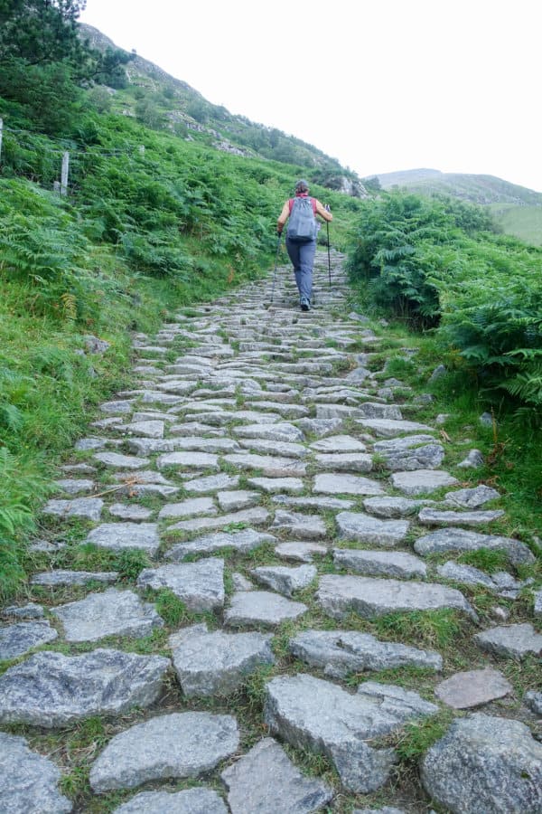
- Lots and lots and lots of stone steps on the regular route
-
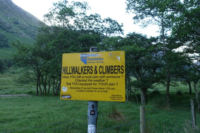
- Wish we had signs like this at every trailhead in western North Carolina!
-
- The first light of day is so special
-
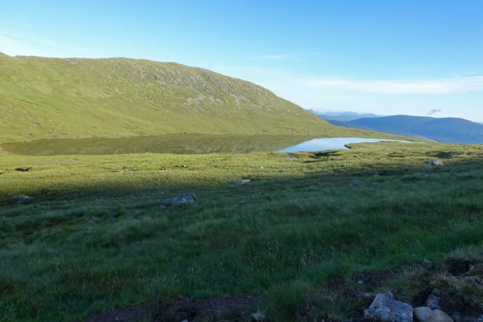
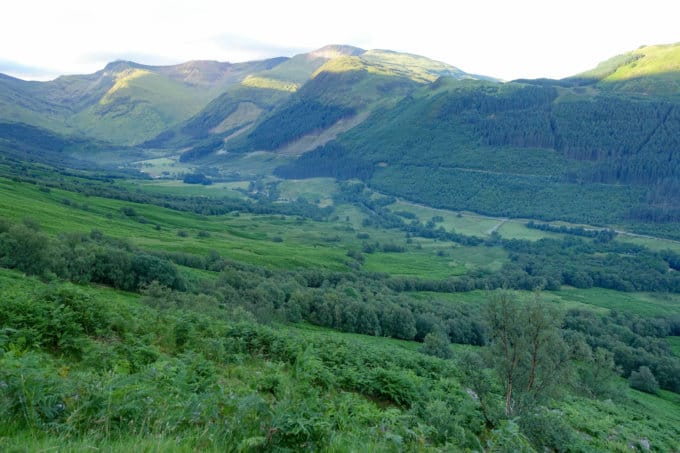
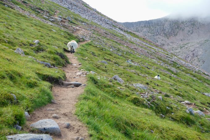
- Where Diana and I parted ways
-
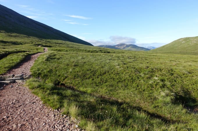
- Last chance to turn back on maintained trail!
The trail quickly disappeared and I was left bushwacking down a steep slope of heather and bilberry. The hillsides of Scotland appear lush and green for a reason, I discovered. They are covered in boggy, wet soil, filled with hidden mud pits ready to sink you calf deep in an instant. If you’re lucky, you’ll keep your shoe on your foot while pulling it out!
I attempted to stay on the GPS track I had downloaded to my Gaia app (outstanding app and well worth the cost if you spend any time hiking, by the way), but I quickly started looking at the track as a suggestion rather than something I should adhere to step by step, contingent on how boggy the soil conditions were along the way.
Ever so slowly, I descended and reached the bottom of the valley where a river cuts through. Since this was a valley, what goes down must eventually ascend when you’re climbing up the next mountain. “Up” in this case meant a sadistic, calf shredding ascent. I kept double checking to make sure I was still loosely on course, hoping for a more gentle path that surely I was missing. Nope, no matter where you looked, it was a steep and relentless climb!
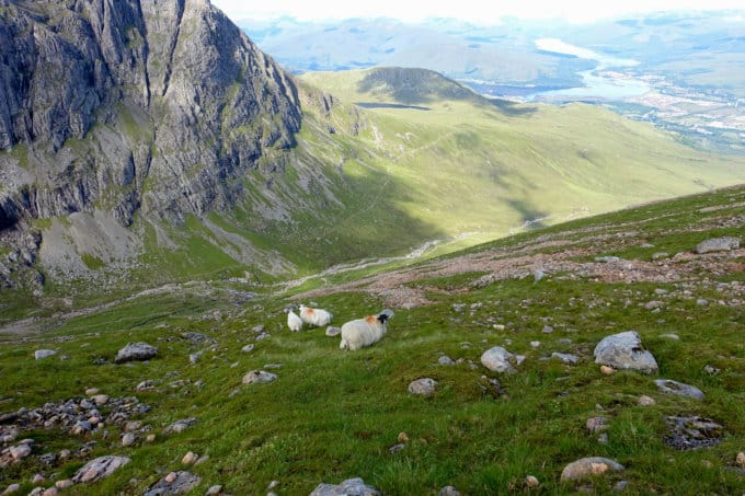
My only companions were sheep until I came across the sole group of people I would encounter until the summit, a guide with four clients also taking this route. He gave me a few pointers for landmarks on the way (which came in handy later) and I continued ahead of them so as not to look like I was trying to get a free guide for the route.
breathtaking views of Ben Nevis’ north face starting to emerge
-
- Getting higher and higher, slowly but surely
-
- Every once in awhile I’d come across a segment of a worn trail which was reassuring
-
- One of the few days with blue skies while we were in Scotland, and I was so thankful for it on this hike!
-
- I felt justified feeling tired after looking back down what I had just climbed up!
-
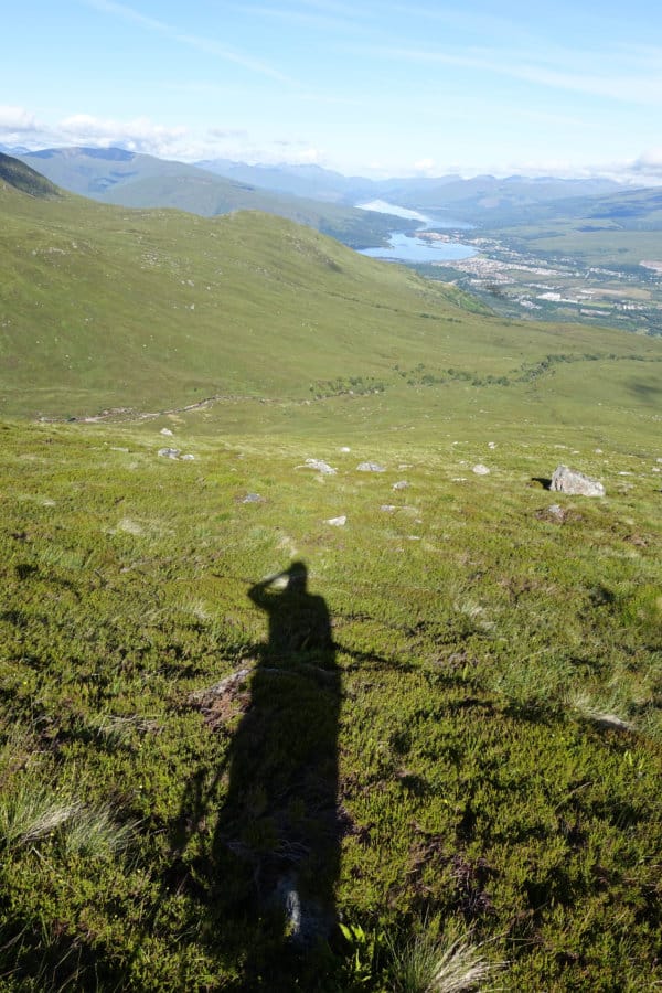
- Feeling on top of the world and I wasn’t even at the top yet!
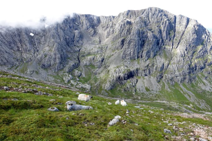
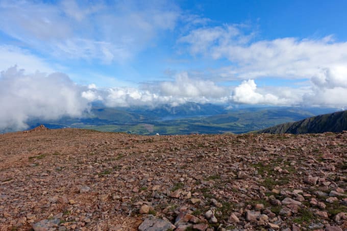
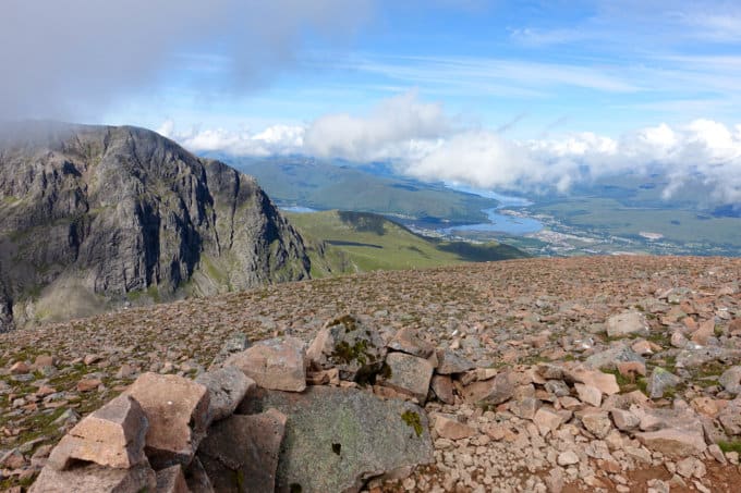
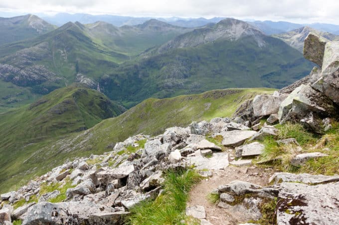
The route was majestically beautiful, the entire northern side of the mountain covered in rock. The clouds started to cover the summit, lending an otherworldly magnificence, and I stopped a few times to just pause and take it all in. But because I had a train to catch to Glasgow in that afternoon, I didn’t linger too long.
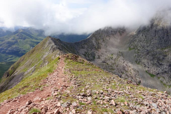
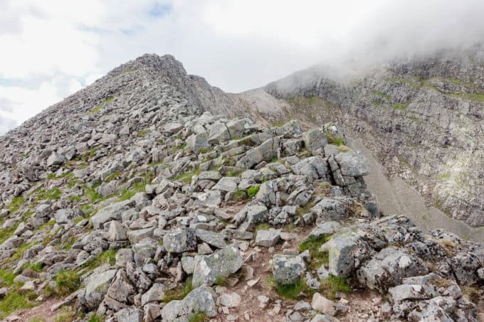
Eventually I summited Carn Dearg Meadhonach and then walked the route through a rocky saddle to the next peak, Carn Mor Dearg. From this point on, things were less aerobically challenging but more mentally taxing. The route follows the spine of Carn Mor Derg to Ben Nevis, requiring concentration, balance and a small tincture of courage to keep going. It was truly safe if you kept these three things in check, but it’s not a route for someone with a fear of heights or younger children (minimum of teenager for my comfort level on something like this).

About to cross the spine of Carn Mor Dearg
After safely crossing the arete, the path becomes even less distinct as you ascend up the final stretch through a large and extensive talus and boulder field. Careful foot placement to avoid twisting an ankle or stepping on a loose boulder is essential, but it was my favorite part of the route. I found countless scars on the rocks from crampons (which obviously weren’t necessary for me in the middle of summer, but in the winter months, I imagine this mountain looks completely different).
-
- The trail dipped off the edge of the spine here and there
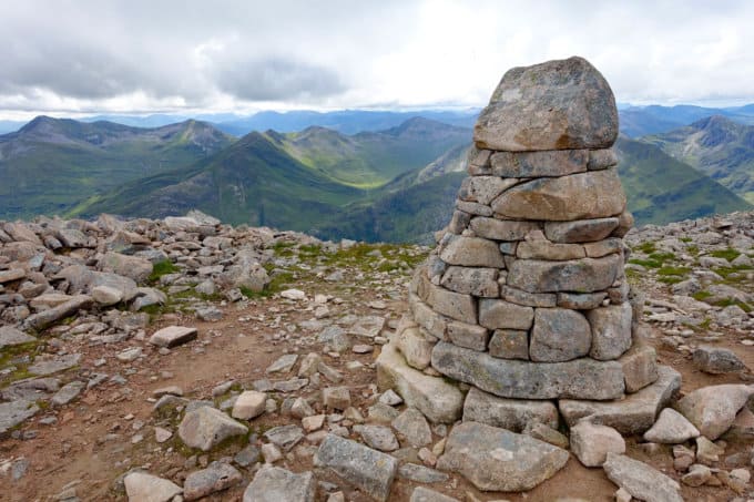
At last, 5-1/2 hours from my start time, I reached the crest of the summit, the crown jewel of the U.K. I looked to my left and realized I was instantly in the company of dozens of people about 50 yards away from me who had hiked the main trail to the top. It was a bit of a shock, ascending in such solitude until the very last second and then automatically being in the presence of hordes of people. I was relieved to see them though, as it signified I had made it to the summit!
-
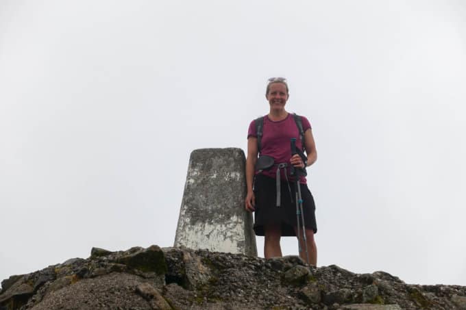
- At the official summit marker!
-
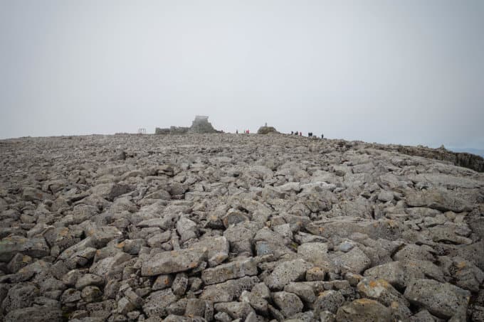
- People–a reassuring site that I had made it!
-
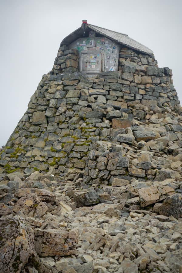
- Shelter hut at the summit
Elated that I made it up without incident, I began the descent on the main trail. After 5713 feet of elevation gain in 7 miles, I was ready for some downhill walking. Except that the waking involved droves of people with me which made it slow going and more mentally challenging to not get frustrated than crossing the spine of the arete! I was thankful to have had several hours of some much needed “me” time to recharge my batteries before starting the long journey over the pond in the morning.
Even though I have only hiked a tiny fraction of the miles that Liz Thomas has hiked, I whole heartedly agree with her assessment of this hike and the stunning beauty of Scotland that it reveals to those who hike it!
Trail Report Card:
The more popular “tourist route” is spectacular in its own way, but if you’re feeling adventurous definitely try the alternative route if you have some navigation skills and “enjoy” a lot of elevation gain in a short distance. There is no trail to speak of (at least not consistently), so knowing what you’re doing and how to read a map is crucial. Take lots of snacks and plenty of water (minimum of 2 liters). The last reliable source of flowing water is about half way up the mountain but the route is covered in sheep, so I wouldn’t dare drink it unfiltered (but I wouldn’t drink any water unfiltered).
Of note, we started our hike at the trailhead across the street from the Glen Nevis Hostel but I ended up taking an alternate route for the last leg on my descent, which ended near the Glen Nevis Visitor Centre Car Park (I grabbed a cab at a pub just off the trail, slightly before reaching the car park). See GPS track below for my actual track with stats.
Overall Grade: A+, but you need some degree of navigational skills, comfort with heights, and to be in good physical shape to tackle the significant elevation gain. If you have all that though, it’s freaking awesome!
Date Hiked: July 5, 2017
Mileage: 13.15 miles
Elevation: Ascent: 5,739 ft; Descent 5,682
Trail Conditions and Terrain: Maintained trail for the first 2 miles then you essentially travel cross country/off trail until the summit. Descending the summit is laborious with all the boulder steps (and crowds) but easy to navigate.
Precipitation: Amazingly dry! Cloudy near the top and I think the summit is often shrouded in clouds and fog.
Suitability for Children: Responsible teenagers would be the minimum age for my comfort level.
Solitude: Once this route broke from the main trail, I only encountered 5 other people (1 guide with 4 clients) Hordes of people on the “tourist route” on the descent down the regular route.
Water: Only in the first half of the hike; take at least 2 liters.
Wildlife Sightings: Lots of sheep; midges were scarce.
Planning Resources:
- I downloaded a GPX file from here into my Gaia app; however, I did not start in the same place it indicated, since I was hiking with Diana for the first leg (we started at the trailhead for the regular route to the summit). Had I followed the route on the GPX file, the elevation gain would have been a little less but the overall mileage would have roughly been the same.
- Book: Trailblazer’s West Highland Way. This was a great book to have on the entire West Highland Way and there was a small section devoted to hiking Ben Nevis with written instructions for this route; however, they weren’t nearly enough (as no written route would ever be), and having a topo and/or was essential.
- Information on the more traditional, “tourist” route up the mountain can be found here.
My GPS Track from Gaia:
This was a fun read and great guide for anyone considering this route up Ben Nevis. Thanks.
Thanks, Mel! It’s the kind of hike you keep reliving in your head, wishing you could go back and do it again! 🙂