My Hike
The following is a trail report for a 40-mile, 3-day backpacking trip which combined the following trails: Snake Den Ridge, Appalachian Trail, Camel Gap, Gunter Fork, and Balsam Mountain Trails. Along the route, I was able to summit the following peaks which are all part of the South Beyond 6000 Challenge (SB6K), sponsored by both the Carolina Mountain Club and the Tennessee Eastman Hiking and Canoeing Club: Big Cataloochee, Luftee Knob, Mark’s Knob, Yonaguska, Guyot, and Old Black. Mount Chapman and Sequoia are also SB6K peaks along this route, but unfortunately I did not officially summit them (more on that story in the trail journal below).
Until recently, I have only focused on completing all the trails in Great Smoky Mountains National Park. I’m closing in on finishing that goal, so it felt fitting to add something else on at this point, especially since the areas I needed to traverse for both challenges parallel each other.
The SB6K Challenge originated around 1968 and has very few completions, relative to how long it has been in existence. It involves summiting 40 of the tallest peaks in the southeast, all over 6000 feet, with some specific criteria involved in “tagging” them. Eight of these peaks are in the vicinity of the Balsam Mountain Trail, Tricorner Knob Shelter, and the 5-mile segment of the Appalachian Trail south of Tricorner. Since I needed all of these trail miles in the Smokies for my map, and my SAR friend, Lane, was planning this SB6K specific trip, no one had to twist my arm to join in on the fun!
Trail Journal
My hike starts on a Friday afternoon. Per the norm, it’s hard to break free from real life and I don’t reach the trailhead for Snake Den Ridge Trail until 12:30 p.m. I have 17 miles to cover with about 6000 feet of elevation gain. My mental math tells me I’ll likely roll into Laurel Gap Shelter around 8:00 p.m., where I’m meeting my waiting friends who are also camping there. There’s not much wiggle room unless I want to night hike, and I’d rather not arrive late and wake up my slumbering friends. So I hit the trail with a keen focus on efficiency.
Safety Snippet: Make sure to leave enough time in your hiking itinerary for unexpected delays. And always carry at least one light source (with extra batteries) in your backpack, along with the rest of the 10 essentials, in case you should get caught out on the trail at dark.
Snake Den Ridge climbs for over 5 miles, sometimes gently and sometimes more steeply. I put my legs in low gear and climb at a slower pace, knowing Gunter Fork Trail will challenge me at the end of the hike, its grade and tread more intense.
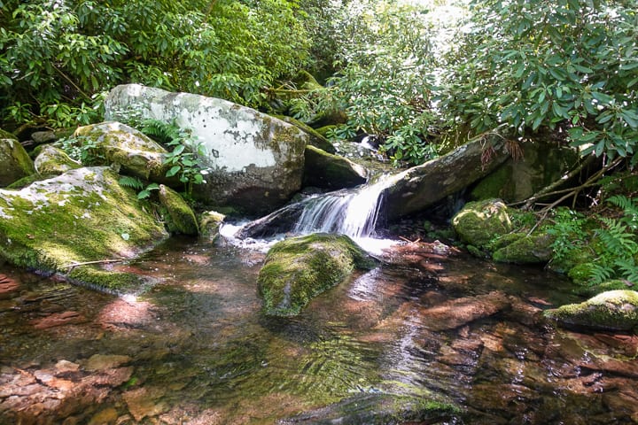
Water is relatively scarce on Snake Den Ridge but crossing Inadu Creek provides a tranquil spot to refill, if needed.
I hit the connector for the Appalachian Trail and meet a couple, probably in their 60s, who have made the journey from Newfound Gap and are ending their day at Cosby, a distance of over 25 miles. I’m always impressed with people in this age range who cover big miles. As the years clip by at a seemingly faster pace in my own life, I want to be just like them when I “grow up.”
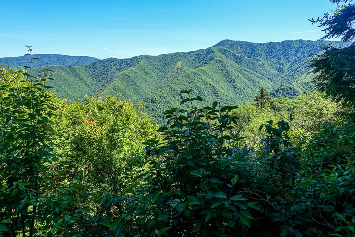
Views from the Appalachian Trail never disappoint in the Smokies!
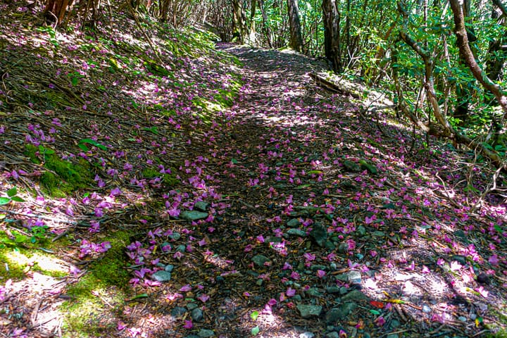
The trail always provides magic.
The Appalachian Trail is gentle along the stretch leading to Camel Gap, and I reach the junction and head downhill. Almost immediately, the trail is covered in overgrowth, but none of it is particularly painful to walk through. I pass through a few scattered brambles overlapping the trail on the way, but what causes more pain is stinging nettles. I should stop and put the pants I brought on, but they nettles are few and far between so I decide to take the sting over the sweaty discomfort of wearing pants.
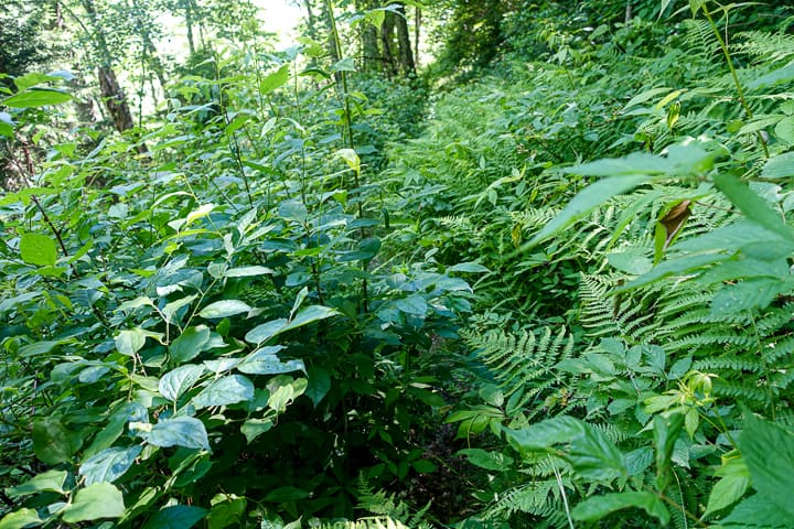
Camel Gap Trail is indeed a bit overgrown in the summer, but it’s not as bad as some trails in the Smokies!
As the trail finally clears up, I round a corner to startle a bear on the trail ahead. He does what a bear should do and bolts ahead, leaving me with nothing but a view of his rear end. I holler to him happily, “Thank you for not charging me, big guy!” After my last hike, I’m not ready for the excitement of being charged again, even if it’s a bluff charge!
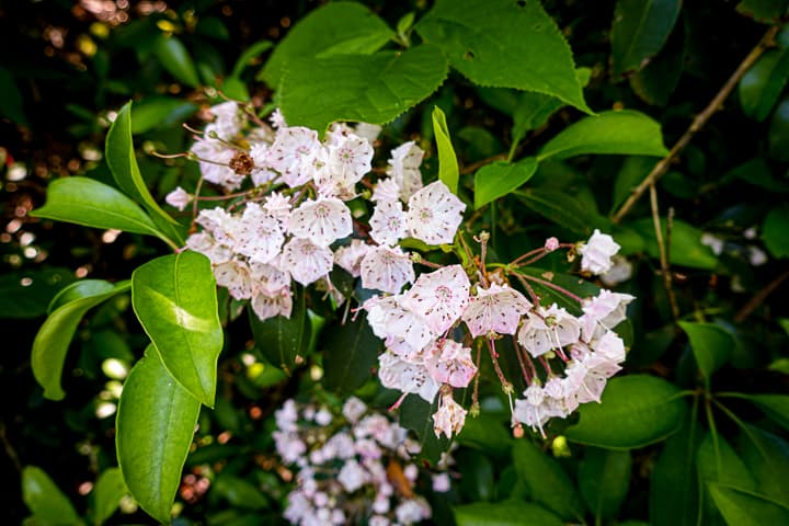
Mountain Laurel
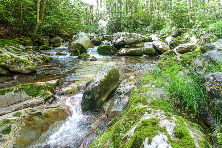
Despite the nettles on Camel Gap, it’s lovely. I have stopped in this exact spot twice while hiking it, to filter water and just soak in the beauty.
When I reach Gunter Fork Trail, my first sizable creek crossing of the day looms ahead. I’m thankful for the mostly dry weather we’ve had and can almost make it across without getting my feet wet; however, to stay completely above water entails walking across a dead tree wedged between two boulders, but it’s thin and the bark is stripped from it. I don’t trust my balance to cross it. Oh well, at least the cool water feels good on my hot feet.
Safety Snippet: When crossing bodies of water, it’s best to wear some form of shoes in the crossing. I hardly ever change into “water shoes” and simply wear my trail runners since they will dry quickly. Some people like to have a specific pair of shoes to change into for the crossings, especially if the water will flood their hiking shoes/boots.
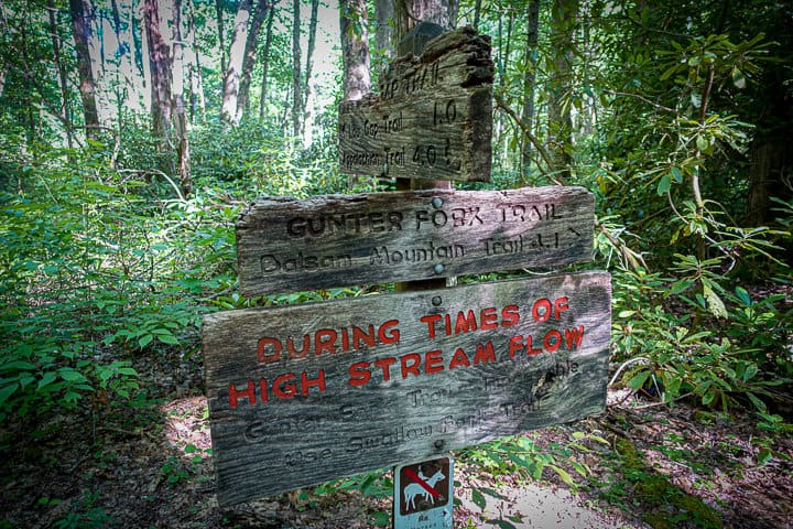
Heed the warnings of high water on this trail, as Gunter Fork can rise quickly to dangerous levels.
There are several more crossings ahead and many of them entail a bit of wading, so all is not lost with my lack of courage on the first crossing. I make my way up the mountain, passing by the first cascade at ~1.5 miles (I now regret not descending off the trail to see it at the water’s edge, as many guidebooks say it’s a “must do”….next time).
Gunter Fork Cascades is around 2 miles into the trail. It’s an unusual cascade and unlike most in the Smokies: An enormous slab with grey conglomerate covered by copper colored sandstone. High above, there is another cascade. I am absolutely mesmerized by the entire scene. As with many things in the Smokies, you simply must see it in person to really appreciate its scope and size, along with its sheer beauty.
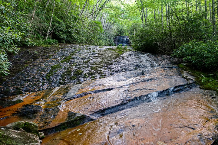
Gunter Fork Cascades
I tear myself away from the cascade and continue my trek upwards. Like the cascade of the same name, Gunter Fork Trail is unusual and has a rugged, wild feel to it. In many places, the trail has nearly eroded away from the mountainside. Careful foot placement is required in many spots and there is even a sizable area of landslide directly on the trail. I wonder how long the park service will keep this trail open, if heavy rains continue to erode it. There are fresh footsteps ahead of mine, but I’ll be surprised to cross paths with anyone this late in the day.
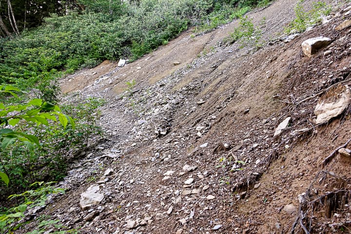
Significant landslide area on Gunter Fork Trail
I reach the top and am elated at how much daylight I still have left with only 1.4 miles to walk. Ridgeline walking on Balsam Mountain Trail is quick and easy, and before I know it I reach Laurel Gap Shelter. I am greeted by 3 men, all camping for the night. One hails from Asheville and it was his footsteps that preceded mine on Gunter Fork. The other two are hiking the Benton MacKaye Trail and I smile, thinking of my own jaunt on the BMT just a few months ago with three of my favorite hiking buddies.
My friends haven’t arrived yet, so I head to the shelter’s water source, a short walk downhill. When I return they are trickling in, coming from different trailheads and distances. We cook our dinners and head for bed, excited for the next day’s adventure.
Day 2
We wake and start our summit bagging early. Everyone in the group except me heads to nearby Big Cataloochee (with plans to also summit Balsam Corner and Big Butt, for one of my fellow SAR team members who is after all the 6000+ foot peaks in Haywood County). I stay back and wait for two new friends joining our mix: Johnny, whose YouTube channel makes me feel like I already know him, and Amy, whom I’ve met previously on a day hike, and whose company I enjoy very much.
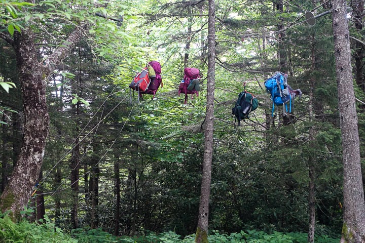
It was nice to have cables to leave our packs hanging from, to go grab nearby Big Cataloochee without the extra weight on our backs.
They eventually arrive, and Johnny and I quickly head out to tag Big Cataloochee. Johnny is just as warm and friendly in person as he is in his videos, and I know we’re going to have a great time today! It’s interesting how familiar the off-trail terrain is, even having only traversed it once in March. We find the summit marker quickly and head back to the shelter to meet our waiting group who returned before us.
Next up are Luftee and Thermo Knobs. Luftee is achieved with a quick-ish ascent up its southeastern flank. The two peaks lie side by side, but the bushwhack between them is rugged and choked with dense undergrowth, with much of the terrain forcing us off the midline of the ridge.
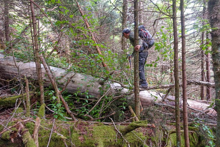
It’s always an adventure traveling off trail!
Safety Snippet: While navigating off trail, the quickest route on the map may not translate into the safest and quickest route in reality. Improvise as needed to choose the safest path to your destination!
After we descend back to Balsam Mountain Trail, our group has a decision: Head to Mark’s Knob, nearly a mile off trail, or hit Mount Yonaguska and/or Tricorner Knob. Johnny, Keen, Terri, and I head to Mark’s Knob which starts on the old Hyatt Ridge Trail but it eventually ends and becomes an interesting bushwhack up to its summit.
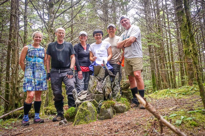
It feel like it takes much longer than it should, but we find the cairn, take our summit photos and head back. Terri, one of the women in our group, is a mother to a 50-year-old daughter. This women is a bad ass. She never complains and is as agile, tough, and strong as anyone in our group. She has also completed 3 full maps of all the trails in the Smokies! I’m simply amazed by her athleticism the entire weekend.
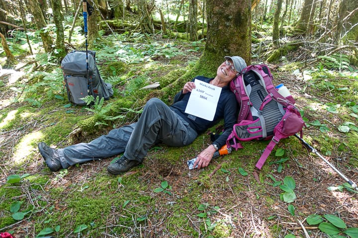
Terri at the summit of Mark’s Knob! Her positive personality is so much fun to be around!
The return trip from Mark’s Knob doesn’t seem to take quite as long and we reach the trail again and head the half mile towards Tricorner Knob, where everyone in the group is staying except for me and two others (who decided to head there hours earlier and skip most of the peak bagging fun). I have nearly 6 miles to go and it’s 6:15 p.m. before I leave the shelter. I fill up on water, eat a quick snack, and bolt so I can once again chase the setting sun. The peekaboo views along this stretch of the A.T. are difficult to pass by quickly though, so I find myself stopping to take some photos and soak it in as I go.
I arrive at Peck’s Corner Shelter at 8 p.m. and find my friends Amu and Lynn winding down for the night. The shelter is nearly full of a group of young men, section hiking the A.T. Most of them are also turning in for the night when I arrive, so I do my best to be quiet as I eat my well-earned (and delicious) lentil curry stew I dehydrated just before this trip.
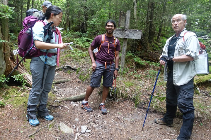
My “last known point” of seeing Amu and Lynn much earlier in the day, before heading to Peck’s Corner where they were also sleeping! I always enjoy their company, so very much.
I climb into my spot on the lower platform of the shelter around 9:30 p.m. and am thankful it’s dark, because it’s my first time on the lower platform of a shelter and I’m scared it would make me feel claustrophobic if I could see.
As I try to will myself to sleep amongst a few snorers, I hear crunching sounds just outside the shelter. It’s accompanied by some grunting and very loud sniffing. Sure sounds like a bear and the bear cables are immediately on the other side of the shelter (and I’m sleeping right against the shelter’s wall). Now I’m really wishing I was on the top platform! 😉
Safety Snippet: The Smokies make it incredibly easy to store your food safely with their bear cables. If you don’t know how to use them, here’s a short video by my friend, Johnny, showing how to use them.
Day 3
I wake in enough time to meet my friends 2.5ish miles away, at 8 a.m., at Mount Sequoia, our first peak for the day. When I arrive at the spot just below the summit (or at least I thought it was the spot just below the summit), they aren’t there yet. I wait…and wait…..and wait for 45 minutes, increasingly anxious that they don’t arrive. It’s not like Lane (our trip’s leader) to be late and especially this late. I decide to move quickly in the direction of Tricorner Knob Shelter, where they all stayed last night, praying that nothing happened to someone.
I meet a southbound A.T. hiker on my way who I saw at Tricorner last night before I left. He confirms that the group left the shelter by 7 a.m. Hmmm, UFO abduction, perhaps?! I keep heading towards Tricorner. It’s my exit route anyway, but I’m still scratching my head as to where they could be.
As I pass Mount Chapman, I hear voices in the far distance. This peak was next on our list after Sequoia, so I decide to stop for a moment and see if I recognize the voices. I do and it’s my group. The voices get louder and louder and within about 5 minutes, they are all in front of me.
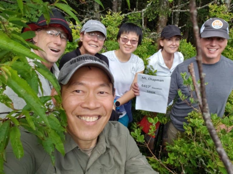
Oh how I wish I was in the summit picture with my friends on Mt. Chapman–next time! (Photo credit: Keen Wong)
In short, my map labeled the summit of Sequoia incorrectly and they were all at the true summit earlier that morning, which is directly off the Appalachian Trail, waiting on me! I’m irritated (with myself) and not sure what to do at this point. Since they have just summited Chapman, I know it’s out for me today. My sweet friend, Keen, offers to go back up with me. But I decline, knowing the last thing he wants to do is repeat his effort. I could head to it myself, but I don’t want to delay our group any longer.
Safety Snippet: Even though I would have felt comfortable summiting Chapman by myself, it’s safer to do any type of off-trail/bushwhacking with another person or group of people, should someone become injured in the endeavor.
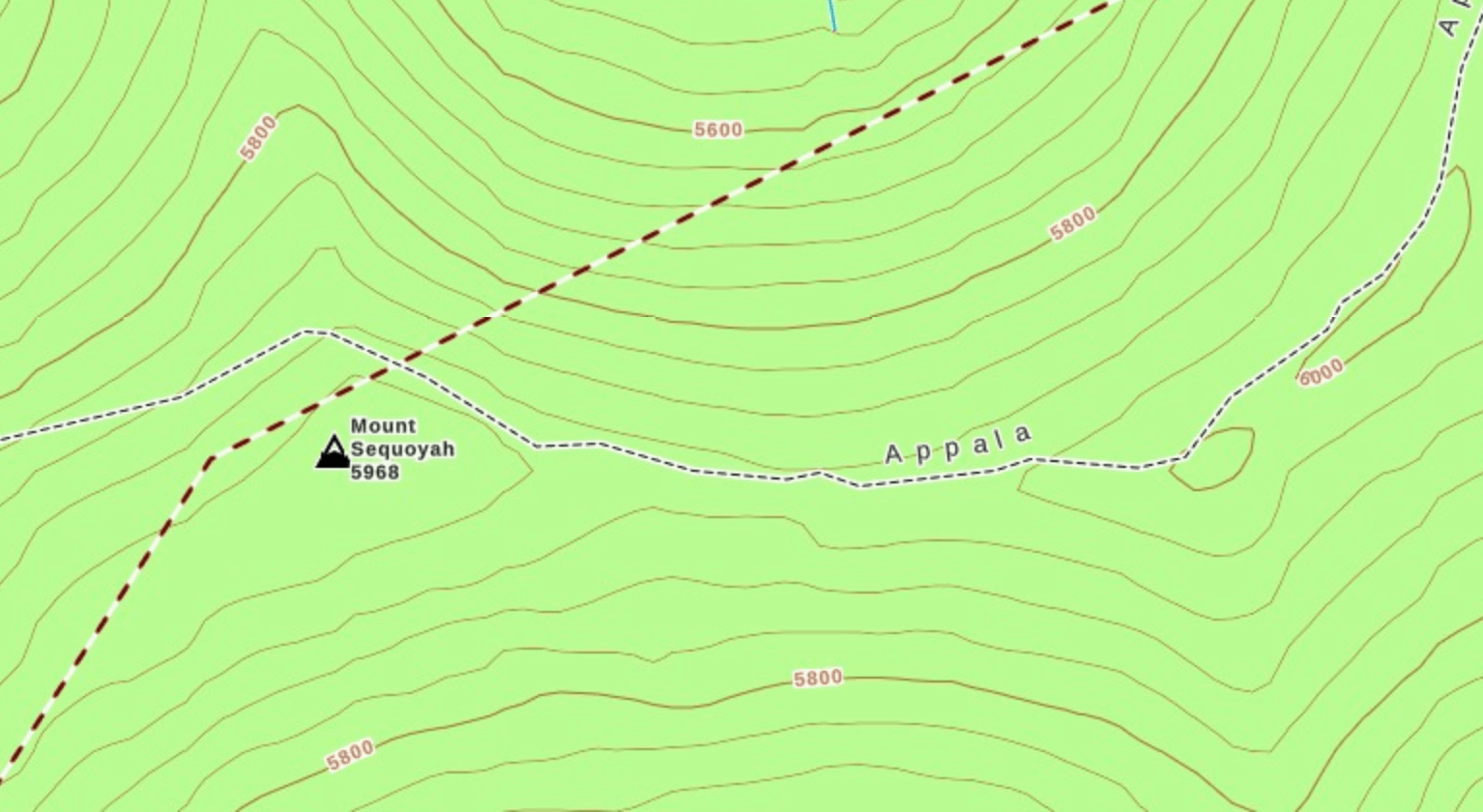
The elevation of Sequoia on this map should have been my tip off that I wasn’t in the right place and that it was to my east (I was sitting on the Appalachian Trail which is the smaller dashed line, below where Mount Sequoia is labeled). Live and learn!
We return to Tricorner Shelter, and on the way back I decide to head out of the woods ahead of my friends, saving all the remaining SB6K peaks for another trip since I missed Chapman (and technically Sequoia since I would need to step off trail a few steps to officially summit it). It’s Father’s Day, and even though I know my husband is happy as a clam without me home since it means he can totally veg out and not have anything planned for the day, I feel like the Universe is trying to send me that way with this snafu.
As we head away from the shelter and our paths start to diverge, my friends towards Yonaguska and me towards Cosby Campground, I have a change of heart and can’t resist joining them. It’s too depressing to think of the fun ending and I’ll just have to hit Sequoia and Chapman on a different trip in the future (and I later learn that my husband was in fact happy as a clam just relaxing!).
Yonaguska has an easy and quick bushwhack to its summit. In the interest of time, we decide to skip Tricorner Knob, since only Yonaguska or Tricorner are required for the SB6K challenge. So we head towards Mount Guyot and Old Black instead, knowing they’ll be harder to earn.
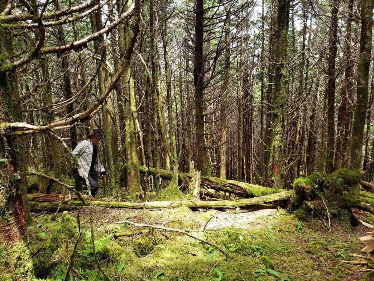
Lane is such an amazing leader on these trips–his attention to detail and knowledge is amazing! (Photo credit: Keen Wong)
As we traverse northbound on the A.T., Guyot looms ahead. It has an ominous and commanding presence, its spruce-fir forest slopes littered with dead trees, killed off by the Balsam Wooly Adelgid in the 1980s primarily. It’s the second highest peak in the Park at 6621 feet, and the highest peak exclusively in Tennessee (Clingman’s Dome edges it out slightly at 6643 feet, but some of its slopes cross into North Carolina).
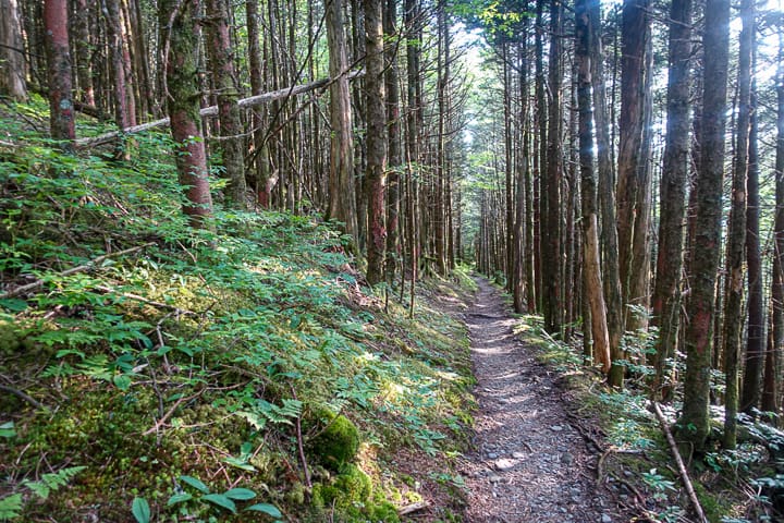
Such a pretty stretch of the A.T. on this section
As we round the western flank of Guyot, we know it’s time to find a line to ascend. There are two known routes to its summit: One is more gentle on the south side of the mountain; but it’s longer, so we decide to just rip the bandaid off and take the shorter but steeper route on the western side. Except the line we choose, starting at Guyot’s spring, is just shy of the true summit. We must first traverse through what I can only describe as an enormous tree graveyard.
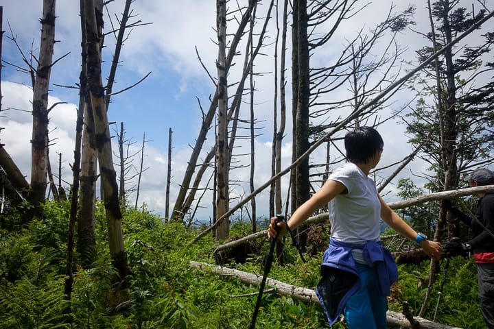
Samantha at the false summit of Guyot, where the tree graveyard prevails
If you’ve ever played Pick-Up Sticks, it’s what the false summit of Guyot looks like. Except the sticks are trees…covered in overgrowth of brambles and ferns and evergreen saplings. It’s the perfect terrain for someone to snap an ankle or leg, but we manage to carefully and methodically pick our way up, over, around and through the debris and finally find the summit.
Safety Snippet: Traversing any terrain off trail is usually a slower endeavor than on-trail hiking. A good rule of thumb is to count on 1/2-1 mile per hour, depending on the conditions. It will almost always take longer than you think it should! And there’s no shame in reversing your route to find a better path than the one you chose on an off-trail excursion. In hindsight, I wish we had done that because of the hazards in this area.
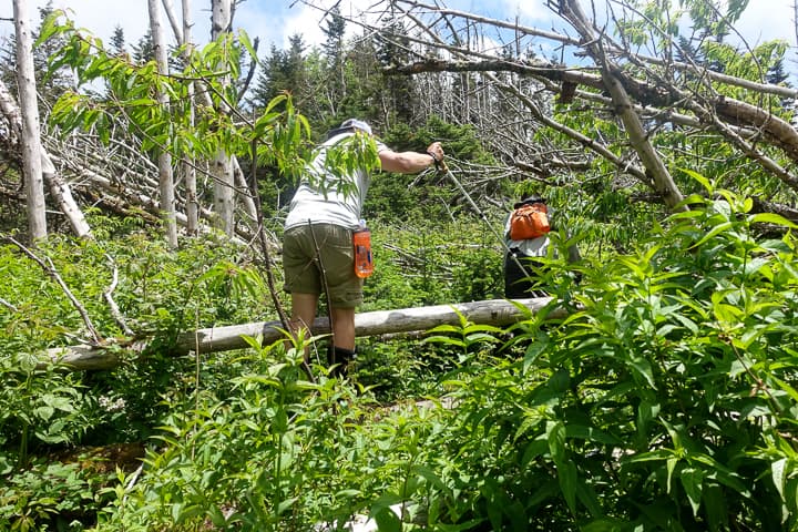
It’s so difficult to show in a photo, but the holes between the stacked deadfall were quite deep through this section.
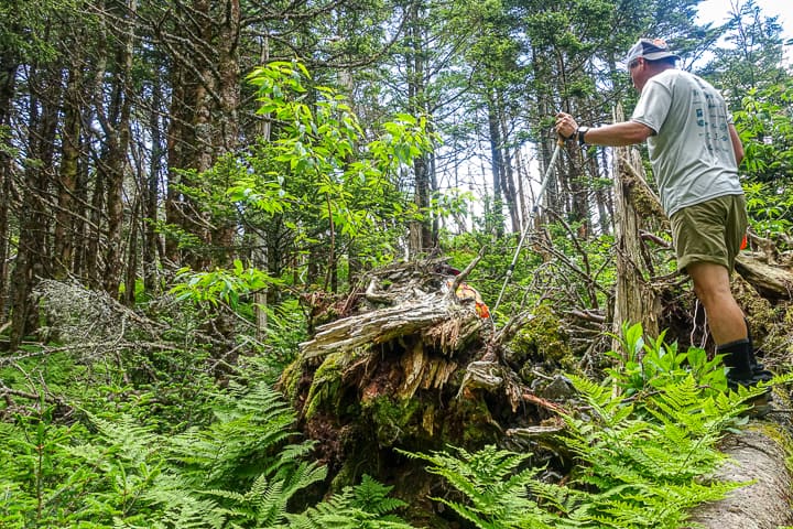
Johnny strategizing his next move through the crazy vegetation on Guyot
We head downhill after a few photos at the summit cairn and marker, this time picking a different line to avoid the hellacious terrain we just traversed. Amy decided to forego this peak and waited with our packs on trail (which was a huge benefit on this particular climb!).
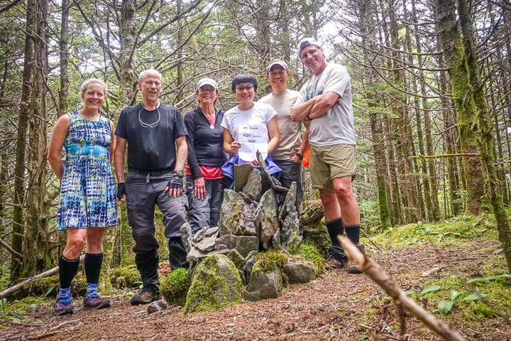
So happy to have finally made it to Guyot’s summit!
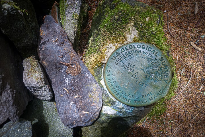
The USGS marker on Guyot’s summit
Next up is Old Black, the third tallest peak in the Smokies. On the map, it appears it will be a quick out and back to the summit from the trail. You’d think we know better by now, that no summit off trail is “a quick out and back!” It actually is manageable early on, but as we crest the climb the true summit evades us, hidden in a dense cluster of undergrowth and evergreen trees. We practically circle the summit before finding a small opening in a seemingly impenetrable cluster of vegetation, earning our right to say we bagged Old Black as we find the summit cairn. I’m still amazed that no one has encountered a single snake through all these bushwhacks in dense vegetation!
Safety Snippet: The two types of venomous snakes in Great Smoky Mountains National Park are the Eastern Copperhead (formerly known as the Northern Copperhead until the taxonomy recently changed) and the Timber Rattlesnake. If you want to learn more about snake safety while hiking, head here to learn how to avoid encounters and what to do if you (or your dog) are bitten by one, until you can get help at a hospital.
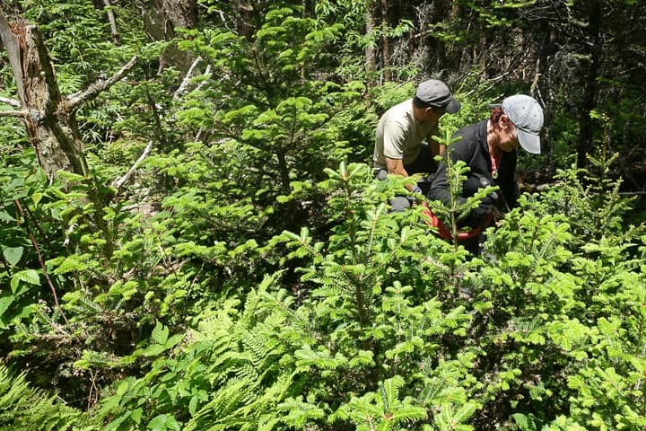
Old Black was intense near the summit!
After we descend, I say quick goodbyes to my friends and head out solo. My plan is to join my family for the evening, and I still need to call my own father, whose adventurous spirit surely plays into my own DNA. I bomb down the trail, making good time on both the A.T. and Snake Den Ridge again. Thunder rolls loudly above me and it propels me even faster.
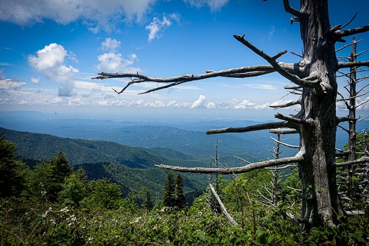
The views do not disappoint along this stretch of the A.T.
I manage to beat the rain and find my car waiting for me at Cosby Campground, just where I left it two days before. Steve, one of our group members and my fellow SAR team member, is waiting at his truck for the others to arrive to shuttle them back to the trailheads from which they started Friday night. He skipped Chapman and Sequoia and bagged Guyot and Old Black by himself. “Kuni” is retired from the Army’s special forces, and I absolutely adore him and his candid personality. He tells me to drive safely and that he’ll “piss on my grave” if something happens. He tells me this is a statement of great respect and he makes me laugh, as he always does.
I head to my family, tired but energized. What impressed me the most on this trip is the fortitude of the people in my company. Many are new to backpacking and hiking, yet they have persevered through some incredibly challenging terrain to reach these summits. They are stronger than I’ll ever be, and it was inspiring to be in their midst!
Safety Snippet: If you’re inspired by reading this and want to tackle the SB6K Challenge yourself, I recommend investing in a pair of safety glasses and sturdy hiking poles, if you don’t already have them. They make the endeavor safer for your eyes, joints, and bones (and tendons and ligaments) too! Pants are a good choice too, for obvious reasons shown in the photo below!
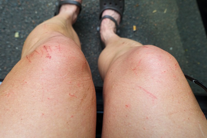
You too can have legs this lovely if you bushwhack in the Smokies in a dress!
TRAIL REPORT CARD and GPX TRACK
Mileage: Total mileage for the 3 days was 40.7 miles.
Type of Hike: If you’re completing the SB6K summits, this was a fun itinerary to complete them. Day 1 could be modified to a shorter route, to reach Laurel Gap Shelter, but taking Low Gap I and II Trails instead of Snake Den, the A.T., and Camel Gap (I just needed those for my Smokies map).
Potential Hazards: The water crossings on Gunter Fork can become very dangerous in high water conditions, and the trail itself isn’t in the best shape. If you traverse this trail during heavy rains, great care should be taken. Off trail hiking inherently comes with more hazards.
Suitability for Kids: For older, fit kids, I personally think the SB6K Challenge would be fun, since it’s not just “hiking down a trail,” which mine are apt to get bored doing sometimes.
Dog Friendly: No. Dogs aren’t allowed on trails in Great Smoky Mountains National Park with the exception of the Gatlinburg Trail and the Oconaluftee Visitor Trail.
Permits: No permits are needed to hike the trails in Great Smoky Mountains National Park, but they are required for camping in the backcountry. Reservation information for backcountry website the park’s website. And clearly, you shouldn’t park in the Cade’s Cove Picnic Area if you plan to backpack this route.
National Geographic Trails Illustrated Map of Great Smoky Mountains National Park
I carry the 10 essentials in my pack at all times and you should too! If you’d like to know what gear I use and recommend, here’s my gear list. I also invite you to join my Facebook Group, where I not only post the best deals on quality gear that I can find, but I also provide education on backcountry safety topics via Facebook Live events. It’s a fabulous group of people and I like to think of it as one of the nicest Facebook groups out there. 🙂
My Gaia Tracks from This Hike
If you are interested in using Gaia, you can get a 20-50% discount off a Gaia subscription (and I highly recommend it). I use it for both SAR and personal use exclusively.
While I have included my tracks in this post, I encourage you to pull our your map and at least speculate where the easiest route to these summits might be, before looking for guidance from the experience of others. It’s a good exercise in learning terrain and map reading (but don’t “bend the map” and think what looks like the easiest route will be the easiest way in reality–often with these particular peaks, it’s not!).
Day 1
Day 2
Day 3
[content-upgrade id=”3163″]

