Trail Journal
I start my day in Elkmont Campground after sharing a site with my SAR teammate and friend, Lane, who is leading off-trail hikes throughout the weekend. I spent the previous day hiking Noland Divide, Pole Road Creek and Deep Creek Trails with two friends. Lane wants to hike all the decommissioned trails in the Park, since he has already hiked the rest of the maintained trails. I’m slightly envious that I can’t go with him, because I’d like to traverse these paths too. But I’ve got work to do on the official trails to finish my map, and I’m leading a hike through GSHAG, so I head out early.
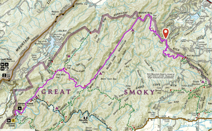
Everyone arrives on time at Abram’s Creek Campground. We’ll be a group of four today, as one person had to bail last minute. We leave everyone’s car but mine in the parking area by the Ranger’s station, and head to the start of our trek at Ace Gap Trailhead. It’s a long haul to get there, nearly an hour, and we get mixed up with directions initially, making it take even longer!
We finally arrive at Ace Gap and start our journey. The walking is easy. The trail is never overgrown or terribly demanding of our strength, so we keep a good clip. It’s always nice to hike with people whose pace is on par with your own, and we’re doing great!
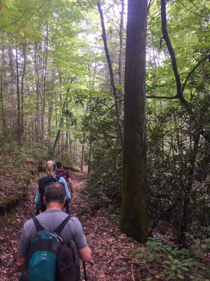
Finally on the move!
Ace Gap is not the most scenic trail in the Park (although beauty is in the eye of the beholder and I hear it’s a wildflower wonderland in the spring), but we’re entertained by the sounds of a pileated woodpecker in the distance. Ben tells me his father used to tell him that if you hear one, it means rain is coming. It’s in the forecast, so we’ll see!
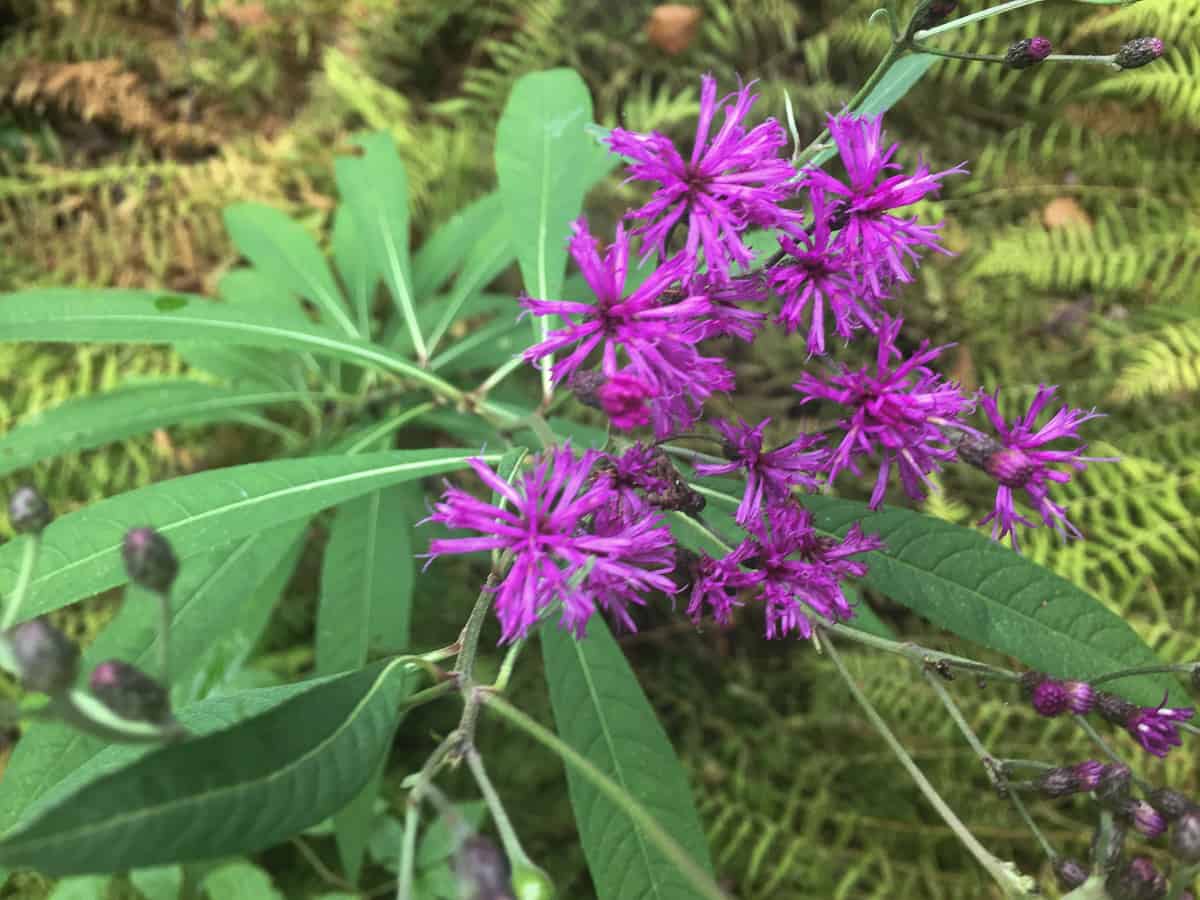
New York Ironweed
We reach the intersection with Beard Cane Trail and head southwest on it. I’ve heard horror stories about the condition of this trail, since a tornado and “super storm” ravaged the landscape in 2011 . Even before we reach it, the trail becomes a bit more challenging, winding its way up a creek bed with deep, muddy spots to navigate around and varying degrees of water depths to carefully balance on rocks and (hopefully) get through without wet feet. I fail at this task and one of my feet lands smack dab in water that surpasses the height of my shoe briefly!
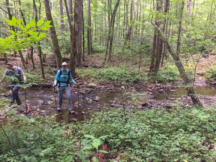
The creek near campsite 3 has an easier rock hop, at least right now with little rain.
I wonder if we’ll know when we reach the area where the tornado carved out a quarter mile swath of destruction, and the answer is a resounding yes. The trail distinctly becomes overgrown with thick briars as tall as me, boggy ground, and no signs of older trees anywhere to be seen. It looks more like a jungle than a southeastern forest. The thorns grab my hair as I pass by, latching on with a vengeance, and I leave quite a few strands hanging from them as I try to pull it loose. Everyone else is as audibly irritated as I am, but we make it through okay. It’s wild to see the destruction, but I’m sure glad to be on the other side of it!
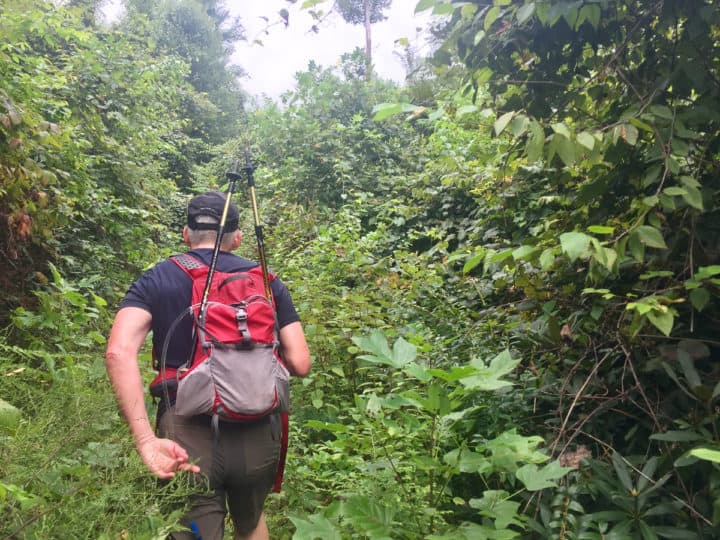
The GNR song, “Welcome to the Jungle” would be suitable theme song for Beard Cane! Ben was our fearless leader trudging through it! This was just the start of it–I didn’t even take photos as we got into the really tall stuff you can see in the near distance!
We start to climb towards the Cooper Road Trail junction and we’re all relieved when we finally get there, since it’s our lunch break. That’s when I notice that my legs have an abundance of battle wounds from Beard Cane. Should have put on my gaiters!
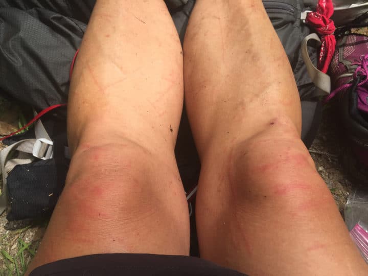
Good thing I’m not a diva 😉
After lunch, we stroll down Cooper Road Trail towards Gold Mine and Cane Creek Trails, which we plan to do an out-and-back hike on. When we get to the junction though, I question how everyone is feeling. Kelsie tells me her feet are bothering her. We take a peek and she has some hot spots forming. She bravely says that she thinks she’ll be okay and that we can stick with the plan, but I worry the extra mileage may send her home with several blisters.
I can tell Kelsie is a “put on my big girl pants and deal with the circumstances” kind of girl, so she’s a hiker after my own heart. She’s gonna be a bad ass once she gets more trails and experience under her feet (heck, she already is, in my opinion).
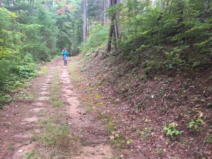
Cooper Road Trail was in great shape along this stretch
We make a group decision to shorten our hike and those of us who need these extra trails will just come back later and hike them. Plus, Ben has to shuttle me back to my car and it will make the day a bit longer than he was anticipating, so it feels like a solid choice to cut the day a little shorter.
Safety Snippet: Foot care is incredibly important on a hike. If you feel hot spots forming, I recommend using Leukotape for the areas. It’s served me well for years when I’ve needed something on my own feet to stave off blisters, and works significantly better than anything else I’ve tried.
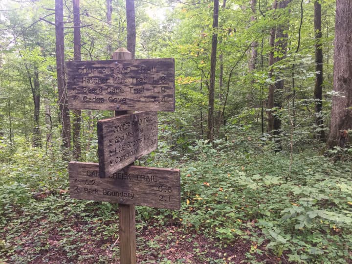
Spaghetti junction of the Smokies
The rest of our hike is smooth sailing and we make good time heading back towards Abram’s Creek Campground. We encounter one other hiker who is headed out on an overnight backpacking trip. He’ll have a quiet night out there, as this area of the Park is far less popular than others.
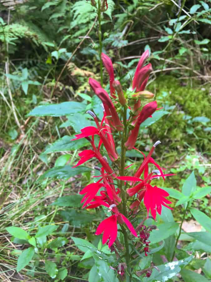
Cardinal Flower
We reach Abram’s Creek and it’s a different scene on a Sunday evening. There are a few scattered campers, in comparison to a chock full campground that I drove through in the morning, looking for the bathroom. Ben and I load up in his car to get me back to mine, while Kelsey and Dan head their own ways. Dan is driving to Colorado the next morning, as he has plans to summit Long’s Peak in Great Smoky Mountains National Park!
Planning Tip: I have been told that Beard Cane and Ace Gap Trails are coveted wildflower hikes during the spring season, before the vegetation has had a chance to get this thick and overgrown.
Turkeypen Ridge Trail
After Ben shuttles me back to my car (and we get turned around again driving to Ace Gap Trailhead!), I have just enough daylight to go do a quick out-and-back 6.8 mile jaunt on Turkeypen Ridge. I stop for a quick Subway sub in Townsend, eat half of it as I drive, saving the other half for a reward after Turkeypen, which I’m not entirely jazzed about doing since it’s starting to rain (those pileated woodpeckers know what they’re talking about apparently).
The rain doesn’t let up, but my hiking umbrella (still one of my most valuable and favorite pieces of gear) is the perfect solution to stay dry from both precipitation and my own sweat. I don’t encounter another soul on my hike except for a solitary black bear who bolts up the side of the mountain when he hears me coming. “Sorry, big guy, didn’t mean to startle you!” I say to him, making a mental note of where this encounter took place, so I can make some noise to warn him of my presence when I’m on the second half of my hike.
Safety Snippet: Rain gear is one of the 10 Essentials so you should always carry it, but make sure it fits the environment you’re hiking in. In the southeast, especially in the warmer months, my umbrella is invaluable. It provides comfortable shelter from the rain versus a rain jacket, which, no matter how “breathable” it is, will soak me in my own sweat as I hike in it. Umbrellas, however, are not good choices when the wind is blowing and/or during thunderstorms.
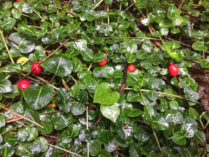
Partridge berries are edible but not very flavorful.
I really enjoy this trail, and it’s a welcome surprise. I thought it would be a “knock it off the list but never return” kind of hike. I suspect I’ll find myself on it again one day though, and I look forward to having a bit more time to enjoy the interesting geological features along the way.
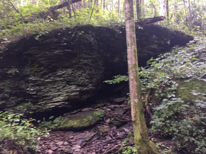
A beautiful rock outcropping at one of the crossings of Pinkroot Branch. It was a bit dark when I took the photo, but it really is a beautiful spot.
I’m able to cruise at a great pace on this hike, and it’s a good thing, because it’s almost dark when I finish. The rain continues as I pull into Cade’s Cove Campground, my home for the night. I duck into the camp store and buy a lemonade. It’s incredibly refreshing after a long day!
Safety Snippet: Always carry a light source with you on a hike, even if you fully expect to be off the trail by dark. It’s one of the 10 Essentials that you should always carry and if you don’t know what those are, I encourage you to head here for your own safety and well being and find out. 🙂
I accidentally took this picture but I liked the motion in it, since I was doing my best to beat the dark and hiking at a good clip!
I find my campsite and set up in the back of my van on my air mattress, thankful I don’t have to set up a tent in the rain (or take it down). I could get used to this van life thing, I think, as I pull out my maps and books and plan out my hikes for the next day, which will include heading back out to grab Cane Creek and Gold Mine Trails as well as a loop out of Cade’s Cove. I’m excited to have another day in the Smokies and it puts a smile on my face as I drift off into dreamland.
TRAIL REPORT CARD and GPX TRACK
Mileage: 15.2 miles for the Ace Gap Route and 6.8 miles for Turkeypen Ridge
Type of Hike: One way, shuttle hike for Ace Gap and out-and-back for Turkeypen Ridge
Potential Hazards: The water crossing on Beard Cane Trail near campsite 3 can be dangerous in high water. For your own edification, The “$1 map” of the Smokies has a very helpful list of all the streams in the Smokies that may be difficult and/or dangerous with high water during or after rain. It’s wise to consult this list before any hike, to see if you might be faced with turning around unexpectedly!
Suitability for Kids: There are better hikes for kids in the Smokies with more scenic value than Ace Gap. I did enjoy Turkeypen Ridge though and there were some cool geological features along the way that might interest some kids. The elevation gain and loss is very manageable as well.
Dog Friendly: No. Dogs aren’t allowed on trails in Great Smoky Mountains National Park with the exception of the Gatlinburg Trail and the Oconaluftee Visitor Trail.
Permits: No permits are needed to hike the trails in Great Smoky Mountains National Park, but they are required for camping in the backcountry. Reservation information for backcountry website the park’s website. And clearly, you shouldn’t park in the Cade’s Cove Picnic Area if you plan to backpack this route.
National Geographic Trails Illustrated Map of Great Smoky Mountains National Park
I carry the 10 essentials in my pack at all times and you should too! If you’d like to know what gear I use and recommend, here’s my gear list. I also invite you to join my Facebook Group, where I not only post the best deals on quality gear that I can find, but I also provide education on backcountry safety topics via Facebook Live events. It’s a fabulous group of people and I like to think of it as one of the nicest Facebook groups out there. 🙂
My Gaia Tracks from This Hike
If you are interested in using Gaia, you can get a 20-50% discount off a Gaia subscription (and I highly recommend it). I use it for both SAR and personal use exclusively.
[content-upgrade id=”3163″]
