We meet at Huskey Gap Trailhead, and shuttle cars to Newfound Gap to start our journey on the A.T. The plan is to hike the A.T south until it bisects the Sugarland Mountain Trail, which had recently opened up after the 2016 fires shut it down for two years. From Sugarland, we plan to take Rough Creek Trail to campsites 24 and 30, our outdoor homes for the night. The next morning, we will retrace Rough Creek to Sugarland, continue on Sugarland to Huskey Gap and head back down to some of the cars we left there.
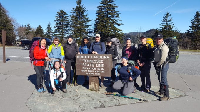
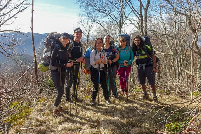
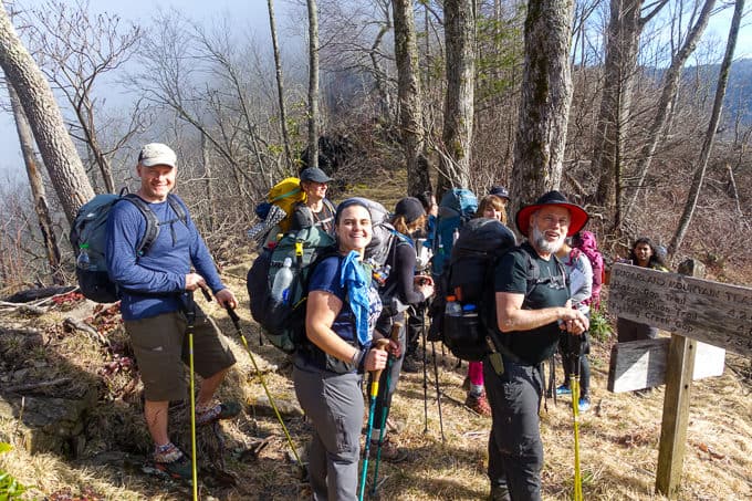
Our group at Newfound Gap, ready to enjoy a beautiful day in the woods together!
I am especially excited about this trip, because it means I can grab some trails in the interior of the park that aren’t easy to get to with a day hike. Sadly though, my husband, Larry, is coming back into town from a ski trip out west and his flight is delayed. My sisters, who are helping me during the day with my kids so I can go on this trip, had not bargained for three tween/teen guests well into the evening. My plan is thus altered at the trailhead to a day hike, and I’ll watch the rest of the crew leave me at the Rough Creek intersection while I carry on towards Huskey Gap to my waiting car.
Despite my disappointment, it’s a wonderful day filled with sunshine, catching up with friends I haven’t seen in awhile, “talking shop” about an upcoming Benton MacKaye hike with two folks who are going with me, and plenty of world class Smokies scenery to soak in the entire time.

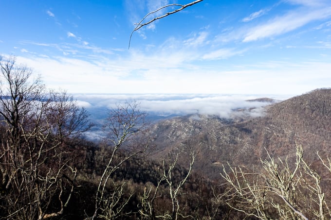
Spectacular views from Sugarland Mtn. Trail!
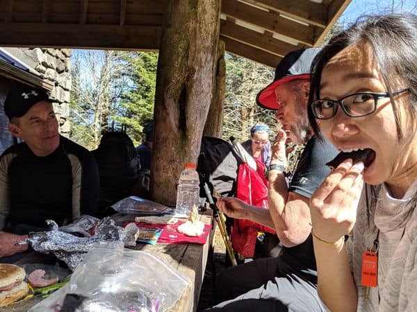
We hike along the A.T. for nearly 4 miles, passing a section hiker as well as a couple of thru hikers. The bubble is getting earlier and earlier on the A.T. and the SAR member in me wants to dig through all their packs and make sure they’re properly outfitted for the incoming frigid weather. We turn off onto Sugarland Mountain Trail and stop shortly thereafter to have lunch at the Mt. Collins shelter. The sun is out, a rarity in our region this winter, and we fill out bodies with both calories and vitamin D.
Lane had a moment of uncertainty and couldn’t remember if he had packed his food for the trip! Luckily, I had plenty to share with him if he had left it since I was now hiking out (he found it in the bottom of his pack though).
We carry on after lunch with Lane, Chris, and me taking the lead. Lane is living proof that age doesn’t need to stand in your way of hiking like a boss (although he’s still young in my book). He was my first friend on my SAR team and I’m so thankful for our friendship and compatibility on trails. Chris, an A.T. thru hiker, is starting a PCT thru hike in May and it’s fun to learn about the permitting process, his thoughts on the excessive snow in the Sierra, and all sorts of things related to a thru hike (and yes, I’m green with envy that he’s doing it!).
We are curious to see how this area has fared since the fires in 2016. Larry and I had plans to hike this trail the summer of 2017, but I made the mistake of not checking the Park’s website for trail closures before we left home, and our plan was rerouted after we discovered the closure signs. For awhile, everything seems completely fine.
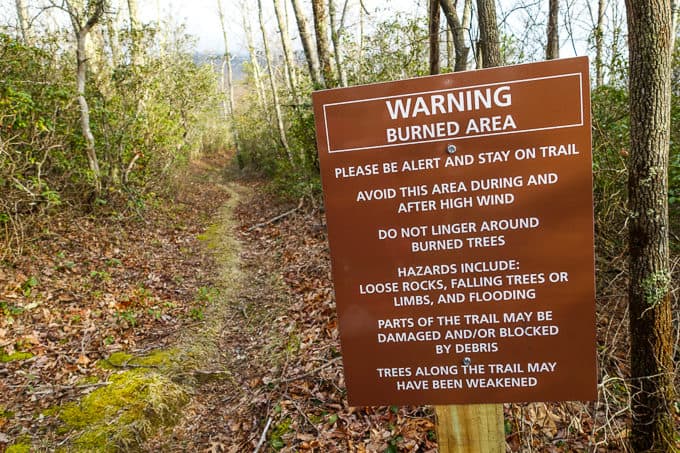
The sign at the start of the Sugarland Mountain Trail at Huskey Gap
We stop so I can shed some layers. We discover that we have stopped in the exact spot on the trail where there is a manway leading to the Chimney Tops. It’s an old trail that’s no longer maintained, but it’s obvious where others have still traveled it.
The Chimney Tops are only about a half mile from where we stand but the trail is very steep and rugged, so we’ll save a bushwhacking adventure for another day. I’m curious to know how close to the top this path takes someone in comparison to the Chimney Tops trail, especially after the burn caused so much damage.
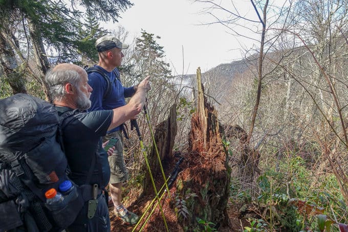
The spot where the manway starts. Chris and Lane picking out landmarks and trying to figure out where the Chimney Tops are in relation to us (you can’t see them from this spot)
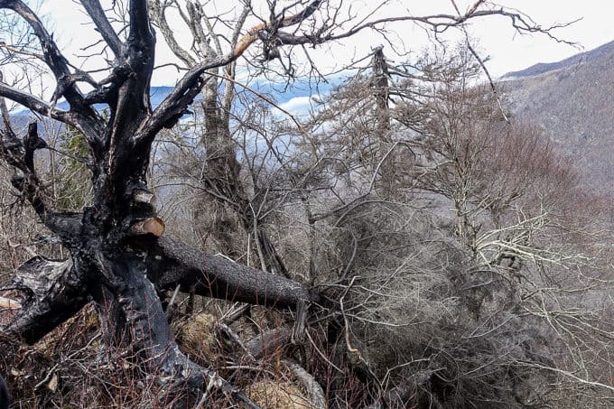
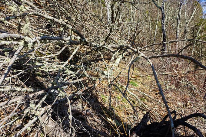
The burned trees were so stark in comparison to the rest of the landscape
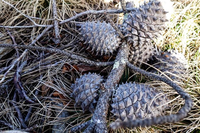
I was so excited to come across my first Table Mountain Pine trees on this hike! The cones have a very characteristic look to them and they’re not as common as other pines in the Park
We carry on and Amy, one of our fellow hikers, is now hiking with us. I enjoy getting to know her better. Not long after, we encounter our first of many obstacles to come in the way of dead fall across the trail. We navigate up off the trail around one, all of us sliding and slipping on the shale covered ground. After we get around it, Chris and Lane decide they are small enough trees to move off the trail. Our fellow hikers are in for a treat, avoiding the workaround we had to navigate!
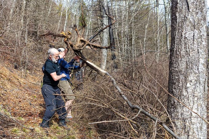
Heave ho! These guys are paying it forward in a big way for hikers to come!
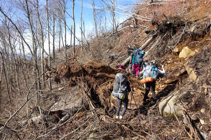
Next, we encounter the biggest challenge of the day–navigating across a huge tree that’s fallen right on the trail. There’s no easy way around this one, and the lesser of the evils is to simply climb up on it and brave our way across.
These obstacles always look way easier to navigate in a photo!
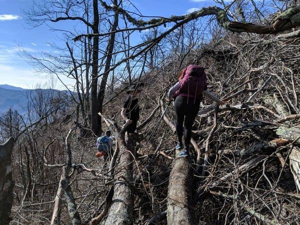
Getting ‘er done
It requires a bit of balancing while walking across it in certain parts where you’re left with nothing to hold onto. When I was a young girl, I took one gymnastics lesson and quit because I immediately hated the balance beam. Walking across dead fall like this, whether it’s over water or land, always brings that memory to life and how I still don’t enjoy this activity!
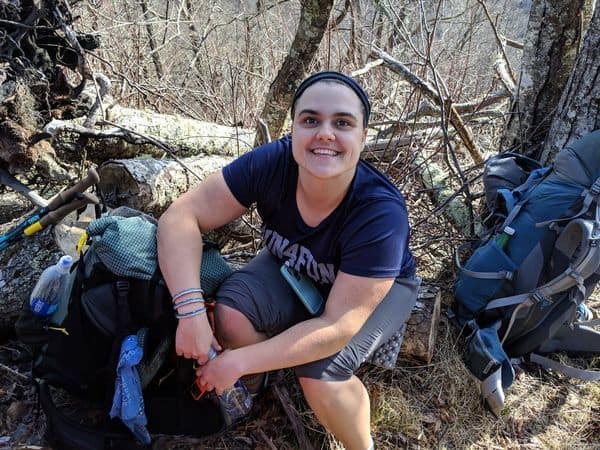
Sweet Erin is hiking half the A.T. this summer! I’m so excited for her!
We all safely make it, and it’s one of the few times I wish I was wearing pants instead of a skirt. My legs are bleeding from several scratches, and I’ll gain yet another scar souvenir or two from a great adventure (good thing I’ve never been a beauty queen to care about such things!).
We decide to wait for the rest of the crew, to help them navigate across it. It’s a beautiful spot to sit and soak in the ridge to our south and have a snack. Everyone makes it across safely, including Ming, who twisted her ankle earlier in the day but doesn’t complain a bit.
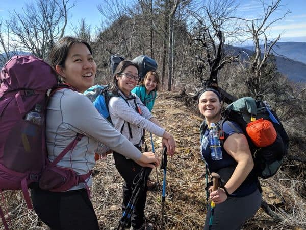
Love these girls and their great energy!
We encounter a few more obstacles but nothing as challenging as what we’ve already faced. Way too quickly, we’re at the Huskey Gap Trail junction and I’m so sad to part ways with my friends! The silver lining is that we’ll have many more adventures to come and these thoughts occupy my mind as I hike on without them.
This one wasn’t nearly as difficult
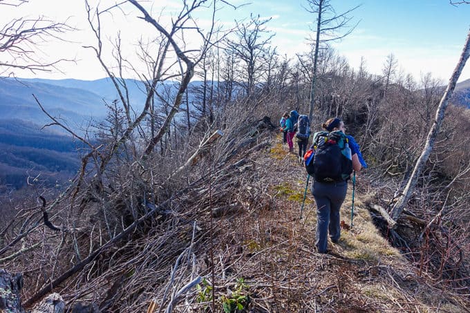
If you’re new to map reading skills, this would be a great spot to pull one out and find yourself on it since it’s about as perfect of a ridgeline as you’ll find!
All smiles on a day like this
The rest of the hike is uneventful. The day has abruptly shifted from warm and sunny to overcast and chilly. I make good time and before I know it, I’m back in my car and heading home.
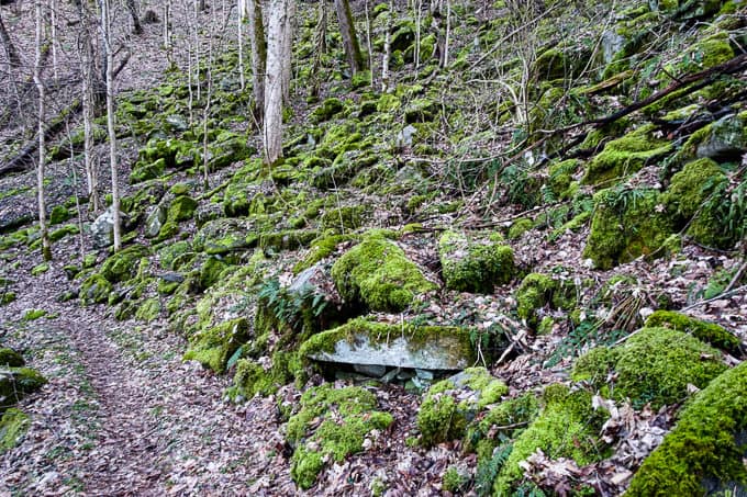
The vibrancy of the moss on these rocks was so beautiful
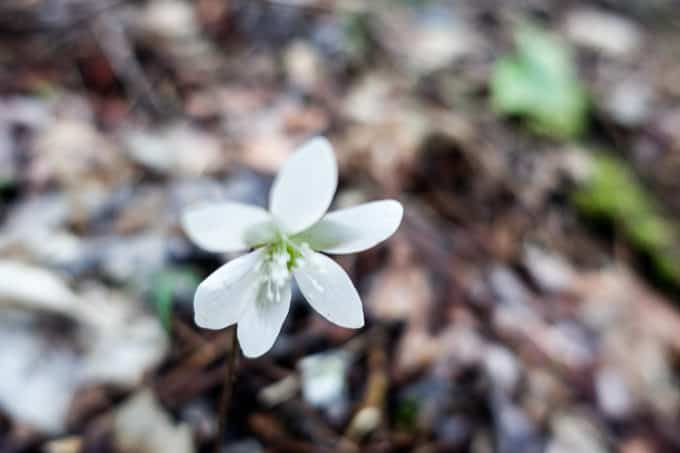
My first wildflower sighting this year–Hepatica! It was a dark area though so it’s not a great picture.
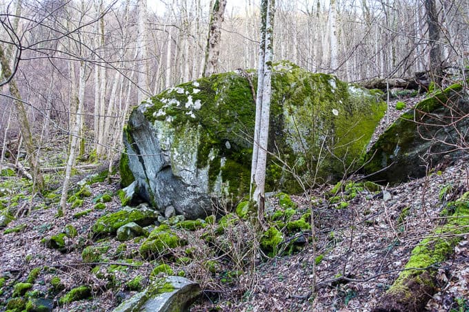
Huge boulders–I always wonder how long they’ve been planted in this spot and how they got there
I return home to a phone call from my sister telling me she’s headed up to our other sister’s house to watch a movie with some of our kids (we watched Adrift which is based on a true story and I enjoyed it more than I thought I would).
If I can’t be in the woods overnight with my friends, snuggling up on the couch with my daughter and watching a movie with a strong female lead is certainly comparable in terms of time well spent. Larry returns home safely a few hours later, and all is well in my world after a fabulous day from beginning to end.
Until next time, I’m left with great memories of both fabulous landscapes and people!
P.S. Special thanks to Amu for letting me use some of his great photos from the day! 🙂
TRAIL REPORT CARD and GPX TRACK
Mileage: 14.9 miles. This hike could also be started from Clingman Dome Rd., when the road is open, shaving 4.2 miles off of the total mileage.
Ascent: 1383 ft. Descent: 4255 ft.
Type of Hike: One way
Potential Hazards: There will remain a potential for lots of dead fall on the Sugarland Mountain Trail, where the burn occurred in 2016. We suspect that the big tree we had to cross had probably fallen since the trail reopened, but it may be some time before it’s dealt with. Use extreme caution when traveling through areas like this and don’t do anything out of your comfort zone if you risk serious injury. Also, campsite 30 is just across a potentially hazardous creek crossing. The water was high when my friends had to cross it on this trip, and it took some time to figure out the safest spot to cross. Rough Creek Trail will also likely be covered in brambles during the summer. It might make for a more pleasant experience hiking it in the cooler seasons when it’s not as overgrown.
Suitability for Kids: I think a lot of kids would enjoy this hike, if they can hike this distance and navigate through the downfall safely. Lots of views and it’s interesting (albeit sad) to be so up close and personal with some of the burn areas.
Dog Friendly: No. Dogs aren’t allowed on trails in Great Smoky Mountains National Park with the exception of the Gatlinburg Trail and the Oconaluftee Visitor Trail.
Permits: No permits are needed to hike the trails in Great Smoky Mountains National Park, but they are required for camping in the backcountry. Reservation information for backcountry website the park’s website.
National Geographic Trails Illustrated Map of Great Smoky Mountains National Park

I carry the 10 essentials in my pack at all times and you should too! If you’d like to know what gear I use and recommend, here’s my gear list. I also invite you to join my Facebook Group, where I not only post the best deals on quality gear that I can find, but I also provide education on backcountry safety topics via Facebook Live events. It’s a fabulous group of people and I like to think of it as one of the nicest Facebook groups out there. 🙂
My Gaia Track
If you are interested in using Gaia, you can get a 20-50% discount off a Gaia subscription (and I highly recommend it. I use it for both SAR and personal use).
[content-upgrade id=”3163″]