My Hike
The following is a trail report for a 27-mile “lollipop” loop hike which combined the Appalachian Trail, Dry Sluice, Cabin Flats, Bradley Fork and Hughes Ridge Trails in Great Smoky Mountains National Park. This hike took place in early May and I completed it as a solo day hike.
Trail Journal
My husband and I have a fabulous deal going in our marriage: Allowing each other the freedom to enjoy a full day for our hobbies during the week, if we’re fortunate enough to angle our schedules for a day off. While I’d love it if my plans could always include his presence, we have several more years left before that’s possible. And if I’m being honest, my “monster” day hikes aren’t his hiking style anyway. So for now, my solo ventures are the perfect way to decompress, returning home with a clearer head to face the challenge of raising three teenagers!
My hike starts at Newfound Gap, the the crossroads of the Appalachian Trail within the Park boundaries. I arrive at 7 a.m., long before the parking lot fills with tourists and passing thru hikers. My only companions on the trail for the first mile or so are early riser birds, serenading me with their morning song.
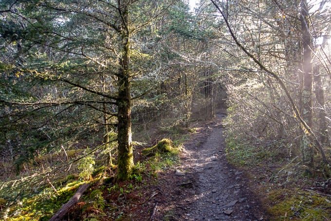
Love the morning light on the A.T. in this section
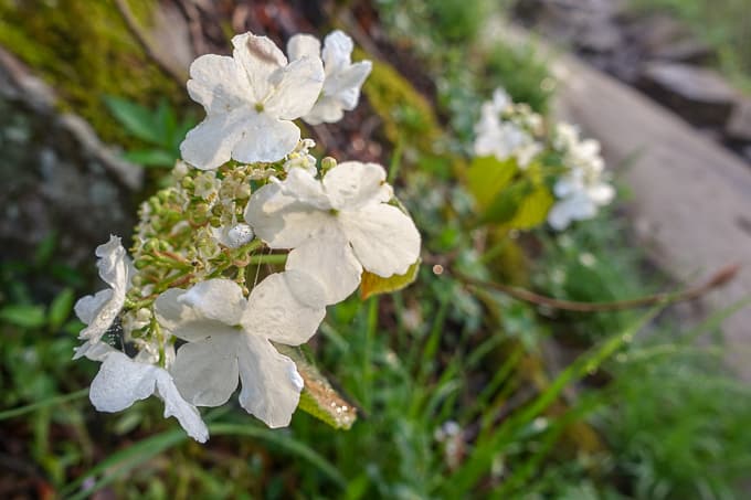
Wild hydrangea
In 4 miles, I reach Charlie’s Bunion and find a thru hiker sitting perched on the massive outcropping which gave this iconic landmark its name. The views are fairly obscured by the cloud inversion, but he’s loving it all the same. He still has the look of a fresh thru hiker–unstained clothes, a smile on his face, and I don’t smell him from my distance of 20 feet or so! We exchange pleasantries and I move on, eager to get “10 by 10” (10 miles completed by 10 a.m.)
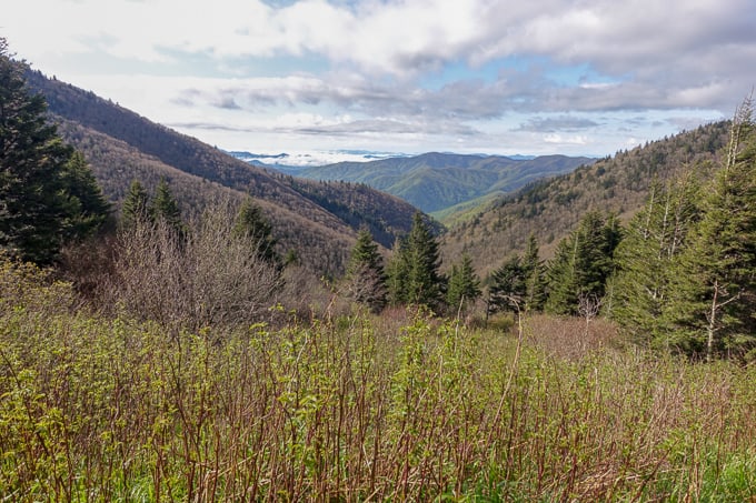
Charlie’s Bunion was socked in but I was treated to this view on the other side of the ridge
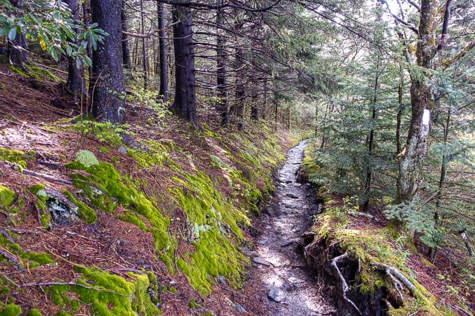
I reach my first trail junction with the Dry Sluice Trail and head down it. There’s a short climb initially, but then the remainder of the trail is a downward jaunt. My hike the previous week on the Old Settler’s Trail was drastically different than this one–tons of blowdowns with my head practically encased in spider webs by the time I walked its nearly 16-mile length. I’m thankful for the well-maintained trail, and I start hiking around in my own head without the distraction of navigating through, under, and around dead trees on the trail.
Towards the bottom of Dry Sluice, I reach a small stream crossing with a badly dilapidated split log bridge. The handrail is missing with only the end posts still intact, both with a nail protruding from the top.
As I carefully step on the decaying (and super slick) bridge, I realize I’m not quite careful enough and immediately find both my feet straddling it, up to my shins in stinging nettle–ouch! My body lunges forward in the slip, and for once I’m thankful for my shorter stature as my hand grabs the post below the protruding nail rather than on top of it!
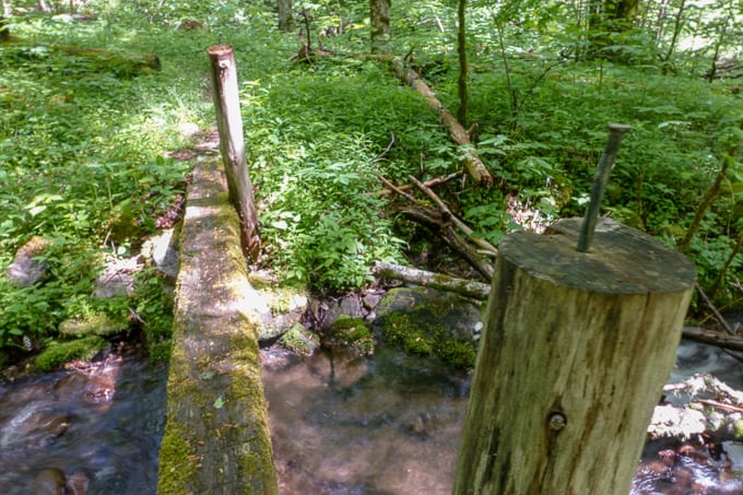
The rickety bridge
I am now extra careful crossing the bridge and continue to cruise down the trail, joined by what appear to be fresh boar tracks. The destruction of the land beside the trail lends evidence to my suspicion and I call out a couple of “Hey boar!” so as not to spook any and incite a surprise encounter.
SAFETY TIP: Wild boar are a non-native species in the Park. They are incredibly destructive and you’ll often find evidence of them by way of upturned soil along the trail. If you experience an encounter with a boar, the same recommendations for bear encounters apply: Do not run, make noise, and try to make yourself look bigger. I find that simply raising my hiking poles over my head to look bigger usually does the trick quickly.
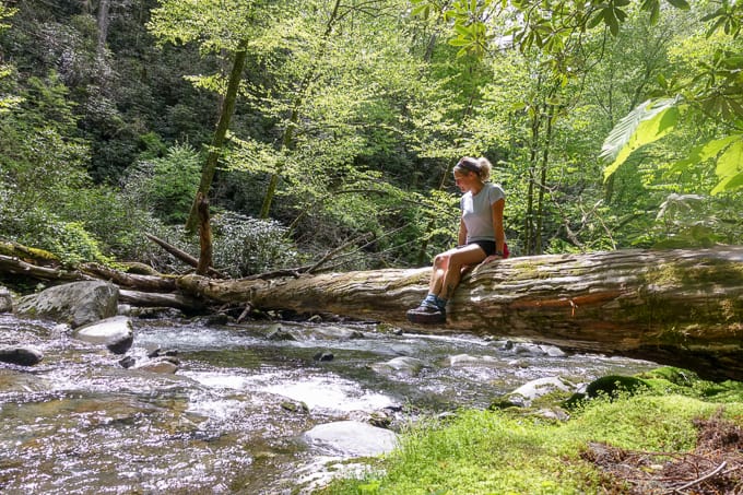
I reach the junction to Cabin Flats Trail and head the 0.8 (or is it 0.9–the map and trail sign differ in their opinions frequently!) to its terminus at campsite 49. I’m awestruck at the beauty of Bradley Fork rolling along beside this large campsite. I could easily spend a very long down time here with a good book. It’s in these moments that I question my reasoning for pulling big mile hikes. But big goals require big miles, so I move on after a short snack break and a couple of photos, placing myself in some of them for a change.
My mom used to tell me she wanted to see me in photos of my hikes, not just the landscapes, since I’m what she loved the most. She’s heavy on my mind as Mother’s Day approaches. I still like to believe she looks at all my photos from my hikes and approves when she seems me in them.
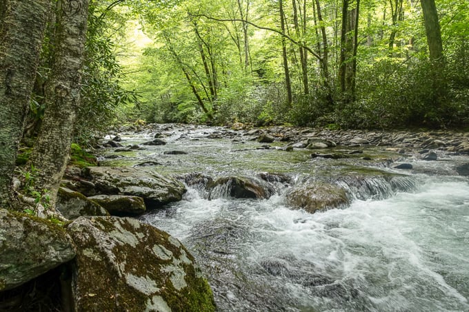
Bradley Fork
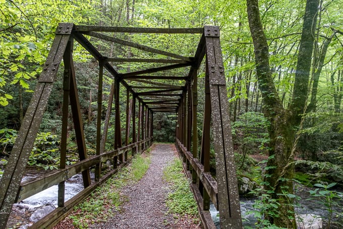
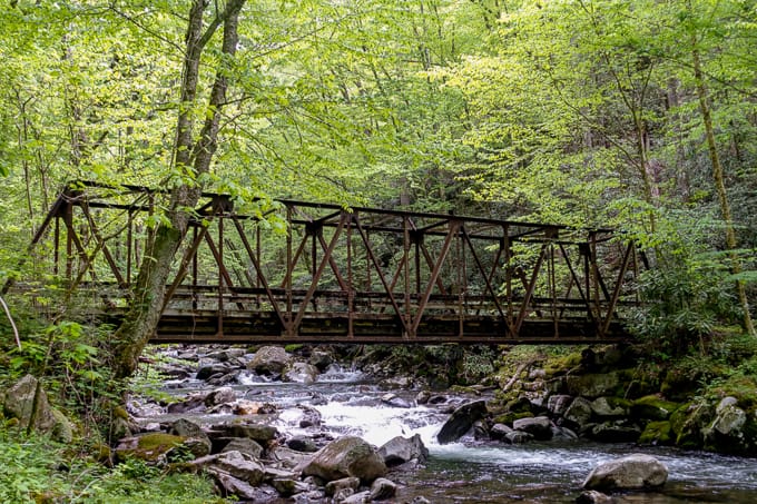
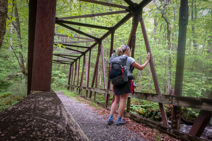
Next up, after backtracking Cabin Flats Trail, is an unexpected surprise–the steel, railroad bridge spanning Bradley Fork. I’m always amazed at these significant man made structures deep in the backcountry. They are a reminder of bygone eras of logging, settlements, and a different scene altogether in this sacred space.
I begin my long ascent back up to the Appalachian Trail via Bradley Fork and Hughes Ridge Trails. The going is easy for the first mile or so, but then the pitch increases for a couple of miles. The tread becomes much more rocky and more exposed with less tree canopy. I find myself intently concentrating on the trail ahead, so as not to step on any unsuspecting snakes who may be enjoying a nice sun bath.
SAFETY SNIPPET: Copperheads and Timber Rattlesnakes are the only venomous snakes in GSMNP. Copperheads are master camouflagers but Timber Rattlesnakes are less discrete and give most folks the courtesy of a good loud rattle as they approach. For these reasons, it’s good to stay alert with both your ears and eyes while traversing snake-friendly areas (sunny, rocky, etc).
Thankfully, this is the only type of wildlife I found on the trail!
I make a deal with myself to not look at my Gaia app as I hike up the mountain. I usually like to occasionally see how far I have left on a longer climb. It works against me though and it’s all I can think about, not looking at it and wondering how long I have left! It’s not even that long of a climb (3.3 miles) but it feels like an eternity since I can’t look. Oh the weird psychology of our minds and the addiction we have to our tech devices!
I reach the quiet ridge line at the junction of the Hughes Ridge Trail, stop for another quick snack, and head north for 2.2 miles. I pass a boarded up building with a pile of something covered by a tarp next to it. I wonder if it’s a storage building for supplies to maintain the shelters along the A.T. Beside the trail is a beautiful Carolina Silverbell tree, reaching for the sun and still holding on to its delicate flowers. Shortly after, I pass Peck’s Shelter and don’t hear a peep from it, but there is a pitched tent in the grass beside it.
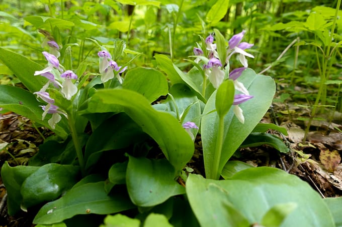
Showy Orchis
When I reach the Appalachian Trail in another 0.2 miles I am greeted by two thru hikers, Flamingo and Locks, both young, full of life and enthusiasm for thru hiking. We chat for a short bit and I’m honored when Flamingo gives me a treasure–one of his 200 tiny plastic flamingos he’s giving to people he meets on the trail. I part ways with them since they want to keep moving and reach a shelter before the predicted thunderstorms move into the area. I’m loving the joy they bring to my day.
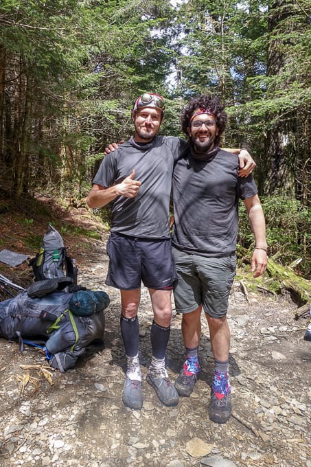
Flamingo and Locks–loved these guys!
I encounter several more thru hikers as I traverse the next 10+ miles along the A.T., back to Newfound Gap. One of them hails from Peachtree City, GA, which is close to where I spent the first 18 years of my life. She is in good spirits and seems to be a contemplative soul who enjoys the moments of the journey as much as the goal of Katahdin.
I encounter a group of guys, heading towards Newfound Gap from an overnight on the Appalachian Trail. Two of them gladly let me pass by since they are hiking slower than I am, but the other two try to pick up the pace instead of letting me pass through. Their pace still doesn’t match my own, and I can tell they’re fairly winded as we continue to climb. I never know what to do in these situations, not sure if it’s rude to ask someone if I can pass by them. So we continue on and I take the opportunity to nosh on the trail mix in my hip belt pocket.
Finally, after about a half mile, I’ve done some mental math and realize it will take significantly longer to get to my car if I have to keep hiking behind them. I’m on the brink of asking them if I can slip by when the one leading stops abruptly at an overlook and says, “We’d better wait for the other guys in our group.” I smile and say, “Sounds good! Y’all have a great evening!”
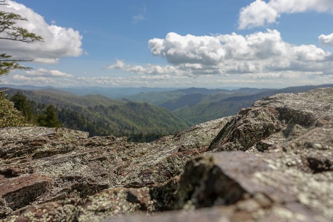
Overlook on the Appalachian Trail
For the last 4 miles, I’m repeating the stretch of the Appalachian Trail I started that morning, and it’s a route I’ve done many times before. I put a single ear bud in and listen to a hiking podcast. It always helps pass the time at the end of a long day on a trail, when the novelty of wildflowers and mountain vistas don’t hold quite the same appeal as they did earlier in the day. The trail is rocky with big step ups and downs in this section, so I’m happy for the distraction from my aching feet.
SAFETY SNIPPET: I would be hypocritical if I said I don’t ever listen to podcasts or music while hiking. Technically, it’s best not to have ear buds in your ears so you can hear things you should hear, like wildlife you may not notice otherwise. I choose to meet in the middle and listen with one ear bud and with the volume very low, and usually only in areas fairly close to trailheads. Also, for what it’s worth, it’s very rude to other hikers to broadcast your entertainment for everyone to hear.
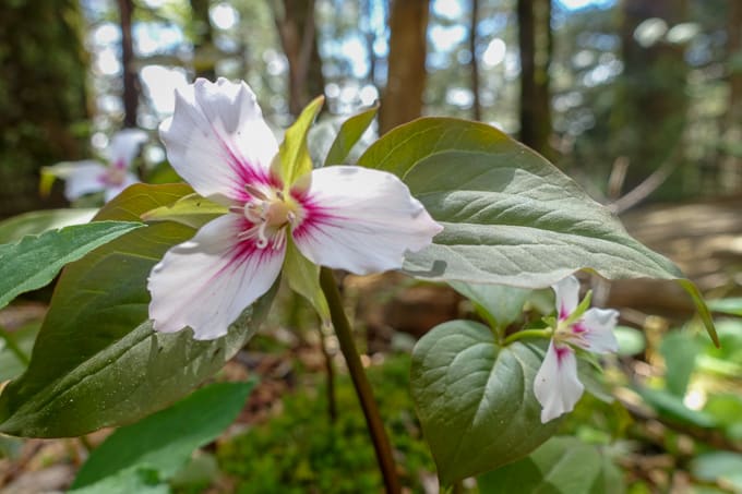
Painted Trillium….so lovely
By the time I reach Newfound Gap, my feet are protesting. Whereas most of my “monster” hikes don’t affect my body much, this one took its toll. Perhaps it was the many rocky sections of trail that contributed, but I suspect a running race I took part in the day before is the main contributor (while I used to be an amateur long distance runner, I seldom run now and would much rather spend my time at a more leisurely 2-3 mile per hour pace on a hike!).
One of my favorite things to do at the end of a long hike, if a stream is available, is to soak my feet in its icy cold water before making my drive home. It provides instant relief to any pain with its numbing qualities! High on the ridge there are no such streams, only tourists milling about for photo ops along this legendary trail. So I change into my sandals and head down the mountain for home with achy feet but an incredibly happy heart.
TRAIL REPORT CARD and GPX TRACK
Mileage: 27.0 miles
Ascent: 5508 ft. Descent: 5511 ft.
Type of Hike: Lollipop Loop
Potential Hazards: The footbridge I mention in disrepair is slippery when damp (which is probably most of the time). Be mindful of the nails sticking out at the posts on either end.
Suitability for Kids: The mileage of this hike would eliminate this from most kids’ lists; however, Charlie’s Bunion makes a fabulous out-and-back option for kids who can handle the 8-mile round trip hike. Cabin Flats (campsite 49) would be a wonderful spot for a family backpacking trip, if accessed via Smokemont and the Bradley Fork Trail.
Dog Friendly: No. Dogs aren’t allowed on trails in Great Smoky Mountains National Park with the exception of the Gatlinburg Trail and the Oconaluftee Visitor Trail.
Permits: No permits are needed to hike the trails in Great Smoky Mountains National Park, but they are required for camping in the backcountry. Reservation information for backcountry website the park’s website.
National Geographic Trails Illustrated Map of Great Smoky Mountains National Park

I carry the 10 essentials in my pack at all times and you should too! If you’d like to know what gear I use and recommend, here’s my gear list. I also invite you to join my Facebook Group, where I not only post the best deals on quality gear that I can find, but I also provide education on backcountry safety topics via Facebook Live events. It’s a fabulous group of people and I like to think of it as one of the nicest Facebook groups out there. 🙂
My Gaia Track
If you are interested in using Gaia, you can get a 20-50% discount off a Gaia subscription (and I highly recommend it). I use it for both SAR and personal use exclusively.
[content-upgrade id=”3163″]