The night before my hike, I sit on the phone with my good friend, Lane, who is a few miles short of being a “900 Miler” in the Smokies. This simply means he will have hiked every mile of designated trail in Great Smoky Mountains National Park. It is my goal to do the same, but it’s taking me 20+ years to complete the task. I want to find a way to incorporate an area with two loops that overlap each other into one day hike, to give me a bit more mileage towards my goal.
Without turning my hike into a 30+ mile day, Lane concurs that it’s impossible to get both loops under my hiking belt. I concede that my 22.5 mile loop will sufficiently challenge my abilities to get out of the woods before nightfall, so I set out to tame my inner wild beast!
Safety Tip: It’s always wise to know your average pace per mile when you’re planning a hike, to make sure you have enough time to complete your route before nightfall, if you don’t want to night hike.
My hike starts from Elkmont Campground and I climb the Jake’s Creek Trail for 3.7 miles. The trail climbs steadily the entire time but I make good time, keeping track of my initial pace to make sure I’ll have enough daylight to finish my entire loop.
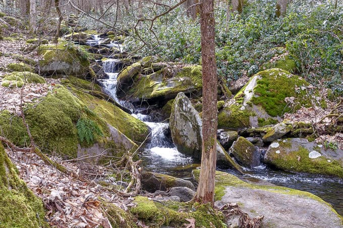
Beautiful Jake’s Creek

Safety Tip: Even if you know your average pace per mile, do a gut check shortly the start of your hike, to make sure you feel good enough from the onset to follow through with your plan. Modify your itinerary if you’re just not “feeling it.”
I reach the top of the ridge and head south on the Miry Ridge Trail, which climbs more gently than Jake’s Creek, offering some nice winter views of both Clingman’s Dome and Mt LeConte in the distance. As I hike along, I encounter lots of fresh tracks that appear to belong to wild boar. Wild boar are a non-native species in the park and are notoriously destructive. There is much evidence of their rooting and destruction along this stretch of the trail, and I start making a bit more noise as I hike. I know they can be aggressive and the last thing I want to do is startle one and provoke that aggression!
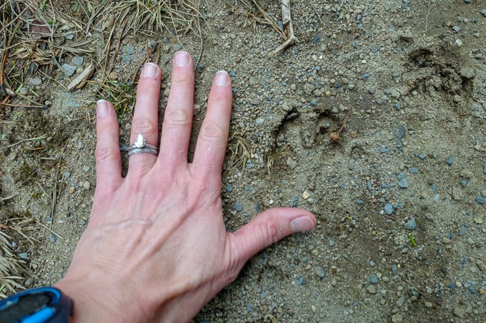
Boar tracks
Safety Tip: While hiking solo, if you are in an area with potentially dangerous wildlife, make extra noise, to alert unsuspecting wildlife to your presence.
My noisy, repeated “Hey Boar!” pays off, as I round a corner and encounter two boar about 50 feet away from me, who appear to have just left the trail. They are bigger than I expected and quite frankly, really ugly! I remind myself to stay calm while I pull my bear spray from my awesome new shoulder strap pouch, while scanning the scene for a tree I might be able to climb up quickly. Thankfully, they don’t have any interest in getting to know me better and trot on by, deeper into the woods.
Safety Tip: If you encounter potentially dangerous wildlife on a hike, NEVER run. Make lots of noise to try and scare it off (whistles are great for this purpose) as well as trying to make yourself look big (raise your hands or hiking poles in the air, step up to higher ground, etc).
Sufficiently fueled by adrenaline, I move along more quickly after the encounter! I’m thankful to come to my intersection with the Appalachian Trail soon after, since I know it’s more likely I’ll have human company along this 2.5 mile stretch.
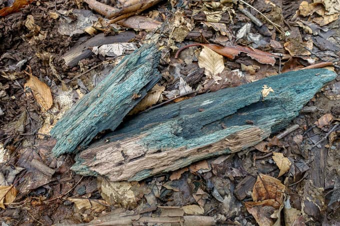
Chlorociboria are what makes wood this color. It’s also known as “green stain fungus.” I just call it beautiful.
I stop for an excellent hot lunch of Italian Couscous from one of my favorite backpacking cookbooks, Backcountry Foodie. It hits the spot and fuels me for the next 13 or so miles I still have left to hike.
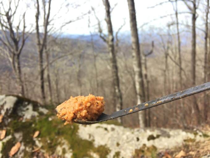
Lunch with a view
Shortly after lunch, I encounter a hiker heading north on the A.T. He is knocking out the section of trail in the National Park over the next few days, and he will start the rest of his thru hike on March 11 with his dog (dogs aren’t allowed in the National Park on trails). He tells me his dog was very upset when he left him at home with his wife for this hike. Soon enough, his sweet pup will have the time of his life heading to Maine with his main squeeze.
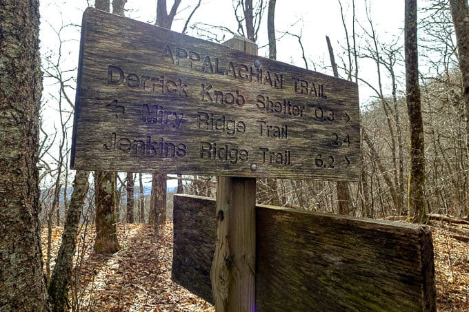
Trail signs are works of art to me.
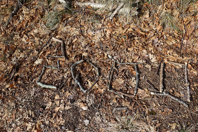
Southbound (SOBO) A.T. thru hikers are surely glad to see this indication of their progress!
I arrive at the Greenbrier Ridge Trail and head downhill for the next 6 miles. It’s a welcome break from the nearly constant uphill hike. There is a spooky story about the Greenbrier Ridge Trail in my “little brown book.” Folklore has it that a man named Jasper Melligan was murdered by two hunters when he was accidentally caught and severely injured in their bear trap. Rather than carrying him out, the bear hunters kill him and throw his body off the side of the ridge. Their story was a secret until one of them is on his deathbed and clears his conscience before he dies. I hope this tale is indeed only folklore!

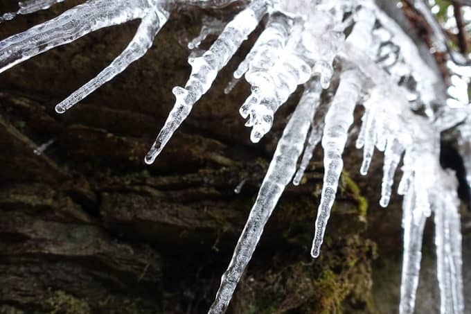
Super cool sap and icicle formation!
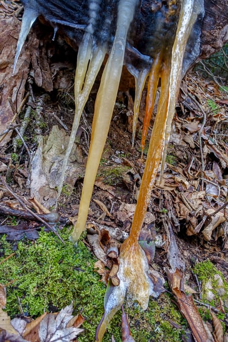
Winter finds are some of my favorites
I encounter one other hiker for the day when I hit the Middle Prong Trail. He’s headed uphill at a fast clip, and I’m descending quickly, so we exchange a quick hello and keep moving. I reach the Panther Creek Trail intersection and am faced with my most challenging creek crossing of the day. This crossing can be dangerously high after heavy rain, but today it’s safely doable by wading across.
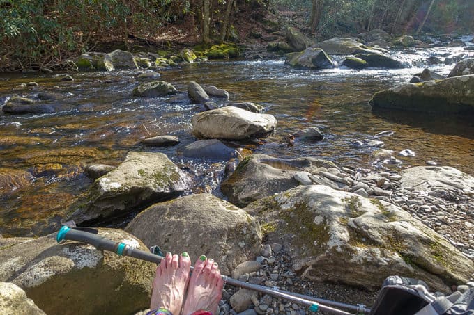
Shoes off and ready to cross–I had to build up the courage for the cold water!
Safety Tip: Before embarking on a hike, check your maps and online references for potentially dangerous creek crossings. If the water had been high in Panther Creek, I would have been forced to turn around and backtrack 16 miles to my car or detour out the Middle Prong Trail and hope to find someone to hitch a ride with to Elkmont, where my car was parked–neither of which I had any interest in doing (and for the record, from my research, I knew this crossing would be manageable the day I hiked).
I make the choice to remove my hiking shoes and switch to my Crocs, which I brought specifically for this crossing. The water is just past my knees in spots, it’s frigid, and the rocks in the creek bed are predictably slippery. It takes a couple of minutes to traverse safely without falling and getting completely wet.
When I reach the other side, my toes are bright red from the cold water! I laugh at the very tired pedicure I treated myself just after Thanksgiving, complete with green toe nail polish to celebrate the upcoming holiday season. My red toes and remnants of green polish are ready for Christmas again!
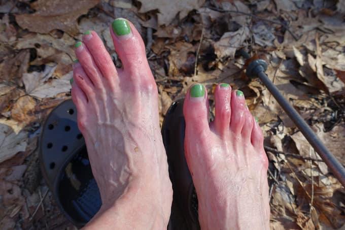
Cold toes and toes in need of some TLC (I’m not good about self care, clearly). 😉
My climbing isn’t over for the day, as the Panther Creek Trail gains about 600 feet per mile over the next 2.3 miles. It goes by quickly though, as the creek follows the trail nearly to the top of the ridge and distracts me from my huffing and puffing as I chug along.
I reach the intersection with the Jake’s Creek Trail, which I first visited earlier in the day as the loop portion of my lollipop loop began. I thought I remembered only having 2.7 miles to hike out on Jake’s Creek, but it’s actually 3.7–doh! At least it’s downhill and I have plenty of daylight to finish the task.
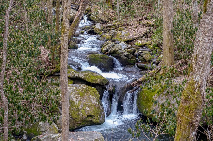
Jake’s Creek never gets old.
The miles go by quickly while I start scheming my drive home and where I want to stop and pick up dinner. My big miles for the day are catching up with my appetite. I’m really craving Chick-fil-A but it would require a trip into Pigeon Forge which sounds about as much fun as a root canal!
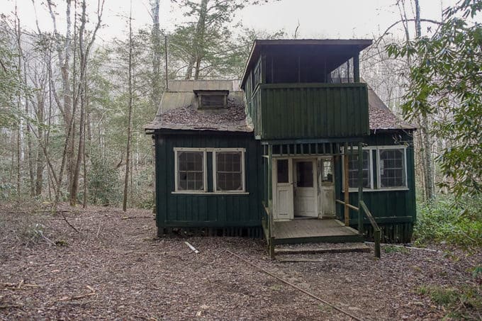
There is still one cottage along Jake’s Creek Trail. I wonder how long it will be before it’s gone too.
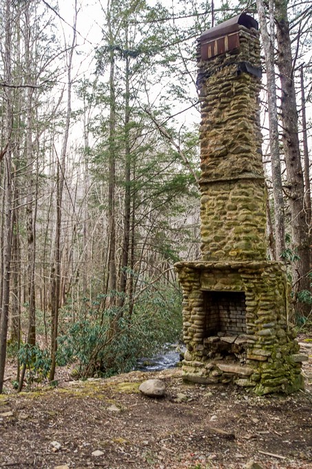
So many of the old Elkmont cottages are gone now, but I love that the NPS left the chimneys.
I make it back to my car, the only car in the parking lot when I arrived and when I left, and I drive out of the park towards Gatlinburg to find some grub. I decide Chick-fil-A isn’t worth the extra distance, but Gatlinburg is an absolute zoo with tourists. I’m stuck in traffic for what feels like forever before finally emerging on the other side of town and finding the least desirable option I can imagine–McDonald’s. I suck it up and hope the fries will be as good as a I remember from 13 years ago, which is the last time I ate them when I was pregnant with my daughter and craving them one day. They’re not and I’m completely disappointed in the experience!
I make the journey home, reflecting on how much good mojo the Smokies always give me and how I can’t wait to return again!
TRAIL REPORT CARD and GPX TRACK
Mileage: 22.6 miles
Ascent: 4819 ft. Descent: 4773 ft.
Type of Hike: Lollipop loop
Suitability for Kids: Not a good one for kids–too long and not enough to keep their interest, in my opinion.
Dog Friendly: No. Dogs aren’t allowed on trails in Great Smoky Mountains National Park with the exception of the Gatlinburg Trail and the Oconaluftee Visitor Trail.
Permits: No permits are needed to hike the trails in Great Smoky Mountains National Park, but they are required for camping in the backcountry. Reservation information for backcountry website the park’s website.
National Geographic Trails Illustrated Map of Great Smoky Mountains National Park
I carry the 10 essentials in my pack at all times and you should too! If you’d like to know what gear I use and recommend, here’s my gear list. I also invite you to join my Facebook Group, where I not only post the best deals on quality gear that I can find, but I also provide education on backcountry safety topics via Facebook Live events. It’s a fabulous group of people and I like to think of it as one of the nicest Facebook groups out there. 🙂
[content-upgrade id=”3163″]
