Panamint Dunes
It feels as if we’re breaking a cardinal rule of front country camping our first night in Death Valley National Park. We’re (legally) camped just to the side of a dirt road with dry, sun-baked ground beneath our tents, hard as concrete. The moon is nearly full as I watch Paige reading in our tent by headlamp, while Larry and I prop ourselves against the hood of the car, enjoying a glass of well-deserved wine after successfully navigating to this remote spot at night. The absolute stillness and quiet of our surroundings is a welcome respite from the urban jungle of Los Angeles, where we’ve traveled from. I don’t recall ever being somewhere so soundless in all my life. Nirvana feels like a more appropriate term than “death” to describe this place, which surprises no one more than me.
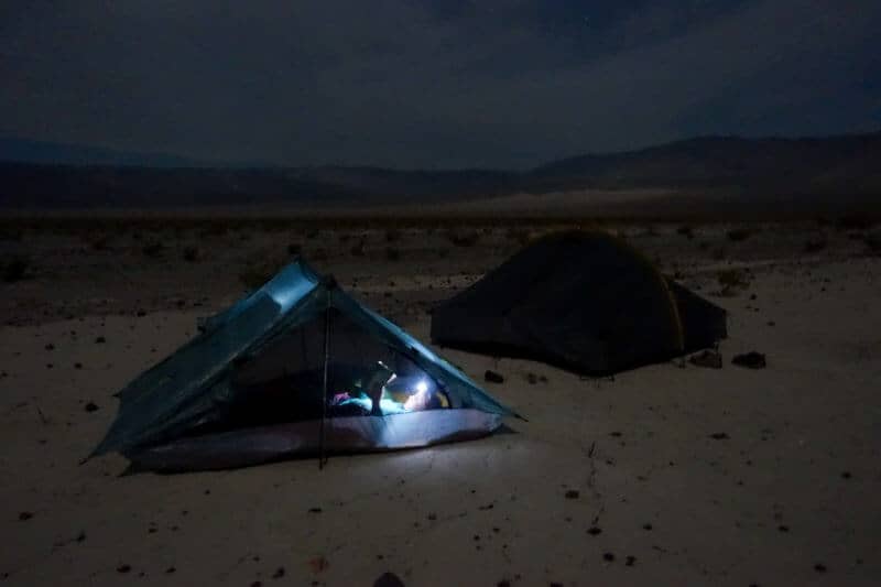
Paige reading in our tent
As I planned this trip I wondered if this park would end my days of waxing philosophic about “America’s best idea.” It conjured up images of the skeletal remains of livestock, intense heat, and a dusty, dry landscape, unfit for human exploration with any joy attached to the journey. The park boasts the highest recorded temperature on Earth, 132 degrees Fahrenheit in 1913, and the lowest point in the United States at 282 feet below sea level. It’s also the largest National Park outside of Alaska, measuring 3.4 million acres–plenty to explore but likely not enough time to even scratch the surface. If our first night is any indication of things to come, however, I chose well.
“They look pretty small, Mom. Do you think it’s worth hiking all the way out there to them?” Aidan asks me the next morning as we eat our breakfast overlooking the dunes in the far distance. “Let’s go and find out. I think you’ll be surprised.” In typical teenage fashion, he’s dubious that his mother knows what she’s talking about. They do indeed look very small, but they are also 3-1/2 miles from where we stand, I remind myself.
Before setting out, I have the kids take a compass bearing in the direction of the dunes. When traveling cross country devoid of any designated trail to reach a destination, it’s always a good exercise to practice, for safety’s sake as much for fun.
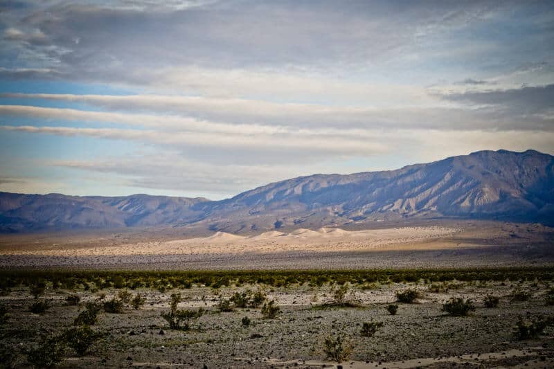
Panamint Dunes in the distance from our campground–they look so small!
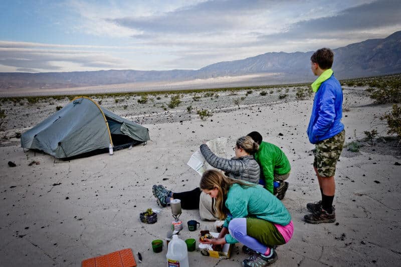
The dubious teenager
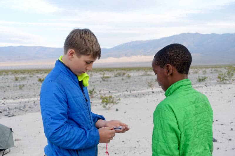
Refresher compass lesson
We walk cross country towards the dunes, the parched earth beneath our feet, a tangible reminder of the scarcity of water here. The sky is overcast, politely shielding us from the intense rays of the desert sun, and we keep good time as we navigate through the brush, the ground becoming more sandy as we approach the base of the dunes at mile two.
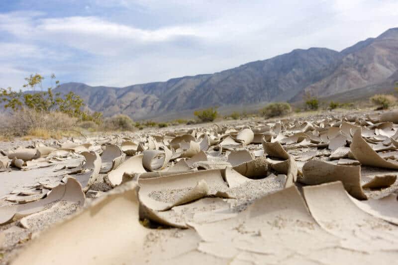
The dry, peeling earth
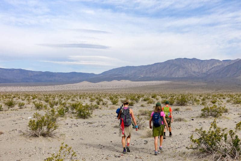
Heading out for the dunes
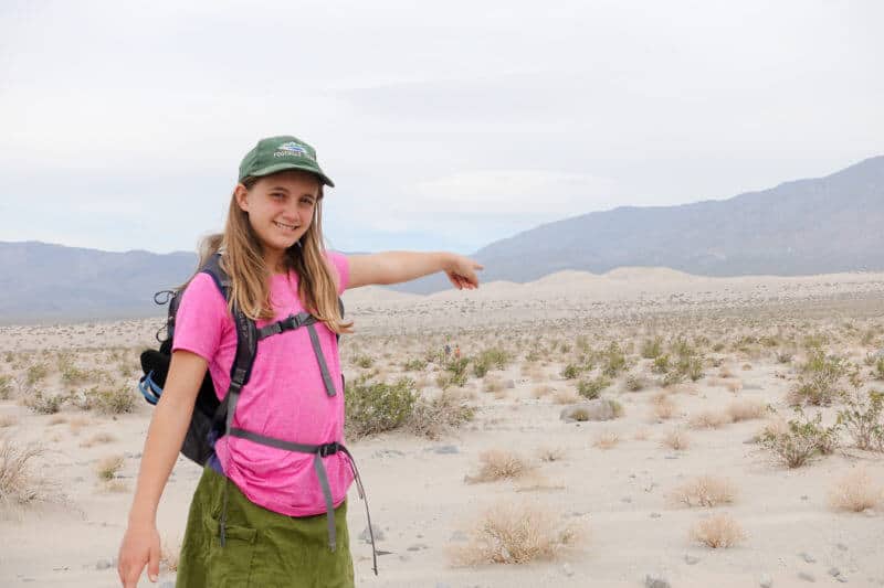
Getting closer!
From this point on, our calves bear the brunt of the physical demand as we slowly but steadily climb into the dune fields. I am ahead with the two boys, while Larry and Paige are further behind. We lose site of them occasionally, as the dunes rise and fall, starting out as nothing but small mounds and slowly increasing in size. If I turn back and squint really hard, I can see our vehicle which looks like a Matchbox Car in this distance.
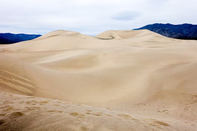
“So are you surprised with how big they are up close?” I ask Aidan. The grin on his face speaks louder than words. My boys race ahead of me, determined to get to the highest point of the dunes before their sister. I linger to take pictures and marvel at the beauty of these enormous piles of sand.
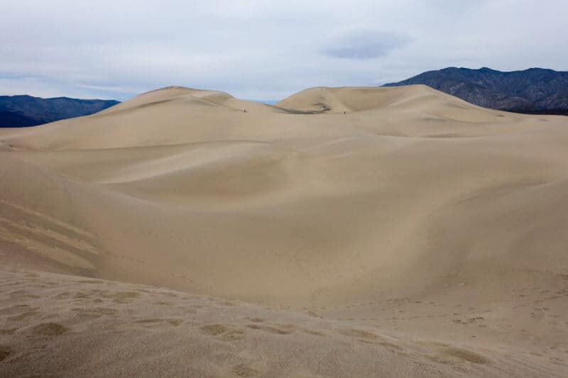
Wogene and Aidan are the tiny specks near the top of the dunes
Larry and Paige catch up to us, the kids take a quick snack break then set to work, exploring every dune they can, running from the crest of one to the other, laughing when their friction of their feet against the sand creates a noise remotely akin to flatulence. Potty humor never gets old in this family, apparently.
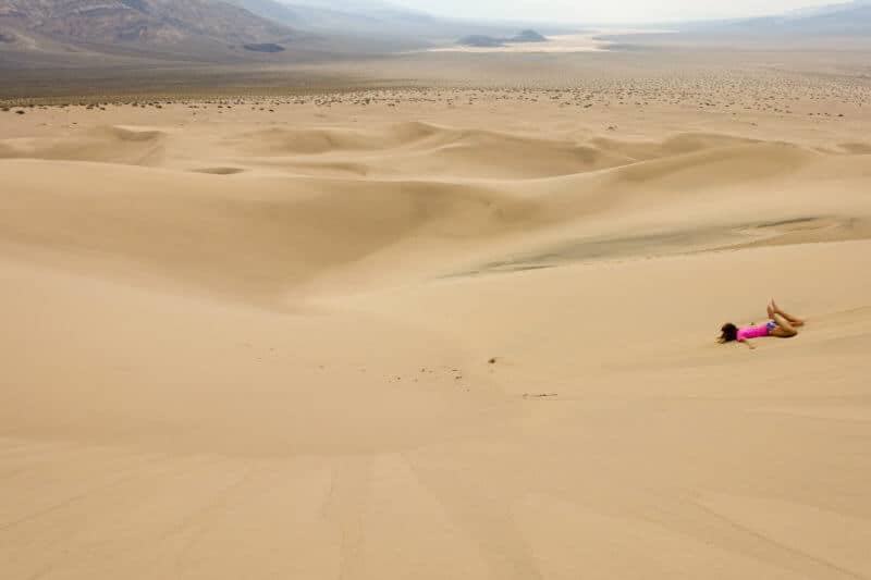
Going down into the bowl was a lot easier than coming back up!
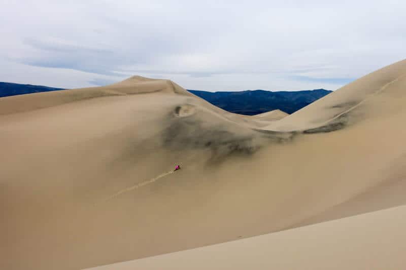
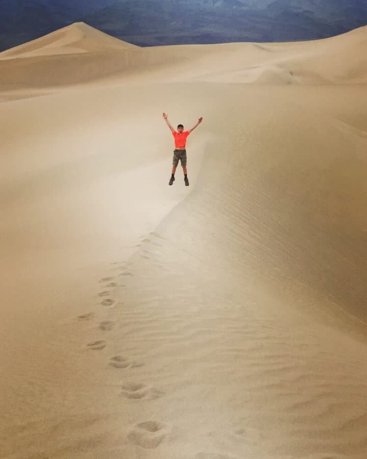
I’d say he was glad we hiked all the way out to the dunes. 🙂
It’s peaceful and we’re the only ones here nearly the entire time until we spot another group on a nearby dune. Then we’re joined by several F-18s in training from nearby China Lake Naval Base. It feels impossible to catch photographs of them as the sound from them isn’t in sync with visualizing them, but they put on quite the show and give the dunes a run for their money in “wow factor” with the kids.
Eventually our stomachs remind us that we didn’t bring lunch with us, so we start heading back. The kids are still amazed at how close the dunes look from the road where we camped but how far they had to walk to get to them. On our return journey, we spot a Black-tailed Jackrabbit hiding in the bush, his enormous ears keeping him cool on this increasingly hot day. He sits frozen for awhile then bounds into the open, where I try to capture a picture of him before he’s gone for good.

Desert Gold wildflower
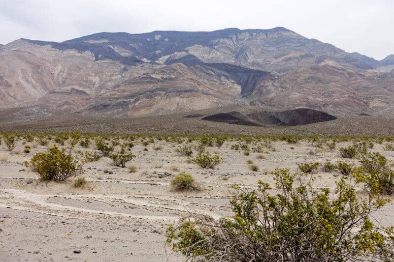
Panamint Butte in the distance
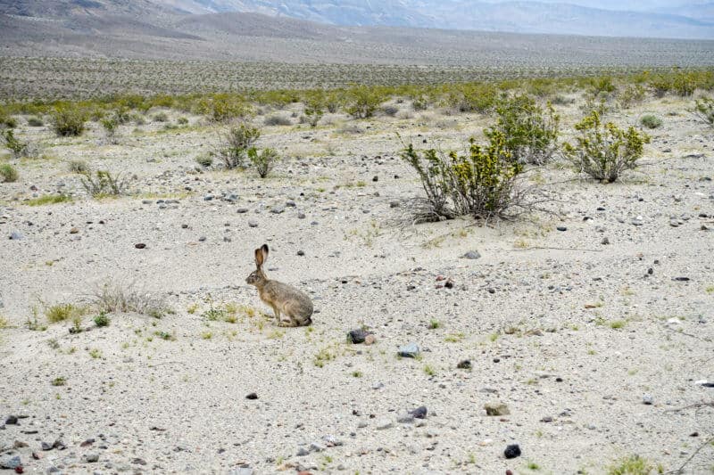
Black-tailed Jackrabbit
We reach the car in good time, pile in quickly, hungry for lunch in Panamint Springs, a blip of a community about 30 minutes away . Our next step after lunch is Darwin Falls, literally an oasis in the desert.
Darwin Falls
After a filling lunch at Panamint Springs Resort (the only food for miles, really, and it’s a stretch to call it a “resort”), we head down the road a bit to nearly reach the western border of the Park and the trailhead for Darwin Falls.
The trail follows a dry, sandy wash for about 0.6 mile, then it enters a lush riparian forest, filled with densely populated willow and cottonwood trees. Rock hopping and muddy stretches replace the dry and dusty trail we’ve been traveling. A bit of route finding is in order among the greenery, but it would be difficult to get lost as steep rocky walls rise on either side of the canyon.
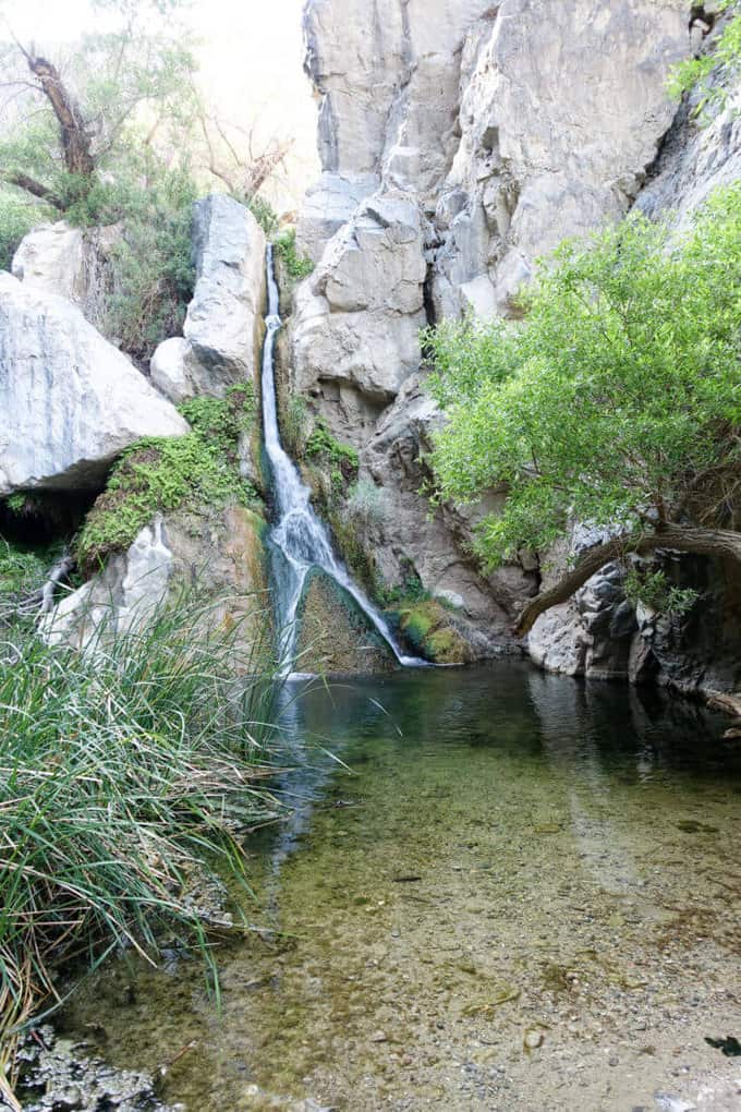
Darwin Falls
At the 1-mile mark, we reach Darwin Falls. I half expect to see little fairies and sprites peeking out from behind the moss and greenery blanketing the rocks behind the falls. It’s that magical of a place. Swimming isn’t allowed in the pool below the falls, so we admire it from the land. There is a cross country route up the southern canyon wall to a second waterfall with three tiers, but some scrambling is involved that I’m not quite comfortable tackling with our kids, so we bid the oasis farewell and head back the way we came.
Resources for Hikes
Death Valley National Park Map:This map was crucial to all our adventure in Death Valley National Park and it’s highly recommend that you take it, along with a compass (and knowledge of how to use them) on any hike in the park.
Hiking Death Valley by Michael Digonnet: This book came highly recommended to me, and I’m so thankful we had it for our trip. Oddly, the author did not cover Panamint Dunes (my guess is because you do not reach them by a designated trail); however, we used the book extensively during our visit and I highly recommend it.
**Using these links to purchase the above items does not add any additional cost to you, but it does earn me a tiny commission to help offset the costs of running this blog, which is my way of “paying it forward” to the hiking community and a labor of love. I appreciate your support if you use them! 🙂
Panamint Dunes Trail Report Card:
Overall Grade: A+.
Mileage: Our total hike was 7.1 miles. There is no designated trail to the dunes, it’s just a cross country walk, so your mileage may vary slightly from ours.
Type of Hike: Out and back. Taking a compass bearing before setting out and again when you’re heading back to the car is a good precautionary measure. If you can’t visualize your car from the dunes to take another compass bearing, calculate a back azimuth from your original bearing. Here’s a great tutorial on doing that, if you don’t know how. In all honesty, if you are hiking in daylight hours, it would be difficult to not find your way back to the road and your car. But it’s always better to be safe than sorry.
Suitability for Kids: This trail is suitable for any child who can comfortably hike a round trip distance of about 7 miles. The “cool factor” of the dunes is well worth the effort if your child is capable of the mileage!
How to Get Here: There is no official trail or trailhead for reaching Panamint Dunes, but the most logical starting point for your hike is located about 5.5 miles up Lake Hill Road which is located off of Highway 190, 4.4 miles from Panamint Springs or 26.3 miles from Stovepipe Wells Village. Lake Hill Road continues past where we parked, camped, and started our hike, but it becomes noticeably more rutted and impassable in a 2-wheel drive car (we had an SUV which served us well, but it isn’t necessary to get this point, if you drive slowly and carefully).
Water Sources: As with most hikes in Death Valley, there are no water sources to speak of, and it’s imperative you bring enough (the NPS recommends at least 2 liters per person for a short dayhike in the “cooler” season and at least a gallon per person for longer hikes) You must drink more water here than in other places.
Hiking seasons
From the NPS Death Valley website: “The best time to hike in Death Valley is from November through March. Summer temperatures can be dangerous in the park’s lower elevations. Even during spring and autumn the heat can be unbearable for most people. Save the low elevation hikes for the cooler winter days. The high peaks are a pleasant escape from the heat in summer, but are usually covered with snow in the winter and spring. If you must climb them during winter season, be sure to be properly equipped with adequate winter clothing, an ice axe and crampons.”
Special Considerations: It’s best to hike this trail in the early morning or the later afternoon. Avoid the heat of the day between 10 p.m. and 3 p.m.
Camping: We camped along the side of Lake Hill Road, which is perfectly legal; however, if we had arrived in daylight hours, it would have been amazing to camp at the base of the dunes (but there are no water sources in this area, so make sure you carry enough in your car and/or in your backpack, no matter where you camp.
Darwin Falls Report Card
Overall Grade: A+. This hike is short and sweet, but how many times in your life can you say you have visited an oasis in the desert? Not many by my own personal count, and this one sure is magical!
Mileage: 2.0 miles
Type of Hike: Out and back. The trail is easy to follow and would be difficult to get lost on, since the narrow canyon leads you straight to the falls. Also, there is a pipe running along the side of the canyon. This pipe (which is leaky in places) transports water from the spring that feeds Darwin Falls to Panamint Springs Resort,
Suitability for Kids: Suitable for younger children with adult supervision, of course. It’s an easy walk and lots for kids to explore and notice along the way.
How to Get Here: Take Route 190 heading west out of Death Valley. One mile past Panamint Springs Resort, turn left on an unmarked gravel road (it’s the first road west of the resort). Take the dirt road for 2.5 miles (it’s a little rough but passable with a car) and turn right into the trailhead parking lot.
Special Considerations: It’s best to hike this trail in the early morning or the later afternoon. Avoid the heat of the day between 10 p.m. and 3 p.m.
Panamint Dunes and Darwin Falls GPS Tracks
[content-upgrade id=”3141″]
I loved Death Valley! You’re right, such a surprise from our preconceived notions of “desert”. Love your photos! My memories from 2011:
http://smokyscout.blogspot.com/2011/10/canyons-waterfalls-and-sand-dunes.html
Your blog was a huge help to me when I was planning this trip, as it is every time I plan a trip where you’ve been! 🙂
Once again, Nancy, a wonderful story. What great memories you are making with your children!
Thanks, Jeanne! I always wonder if they’ll do this kind of stuff on their own or with their own kids one day. I sure hope so! 🙂