This year, I compressed my orders into a shorter time line, finishing them the day the kids got out of school for their break. I’m not sure it helped my sanity, but it did allow me one day of freedom to go for a hike.
I needed something short, close to Waynesville, dog friendly, and with an epic view to refill my emotional tank and celebrate the success of surviving another chaotic baking season. The aptly named Pinnacle Point hike in Sylva was perfect.
The east and west forks of Fisher Creek within Pinnacle Park were once part of the Sylva watershed until a larger water source was needed to supply the growing population. In 1991, the Pinnacle Park Foundation developed hiking trails within the 1,100 acre park, leading to both the Pinnacle, my destination for the day, and Black Rock to the east. Both spots offer high elevation panoramic vistas within the Plott Balsam range.
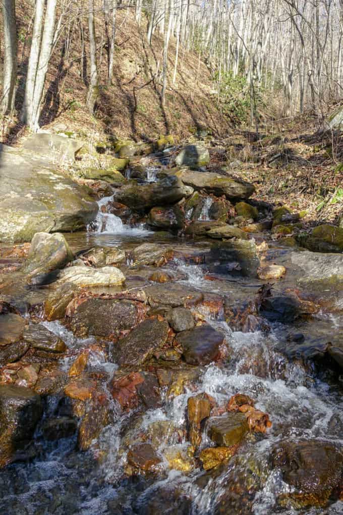
Fisher Creek
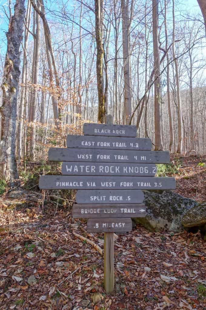
From the trailhead, you immediately begin climbing on a rubbly old road bed with purple and gold blazes marking the way (the color scheme paying tribute to nearby Western Carolina University). At roughly the quarter-mile mark, there is a trail junction for “East Fork” and “West Fork.” The East Fork, a more strenuous climb, leads to Black Rock. Since my destination was the Pinnacle, I took the West Fork trail.
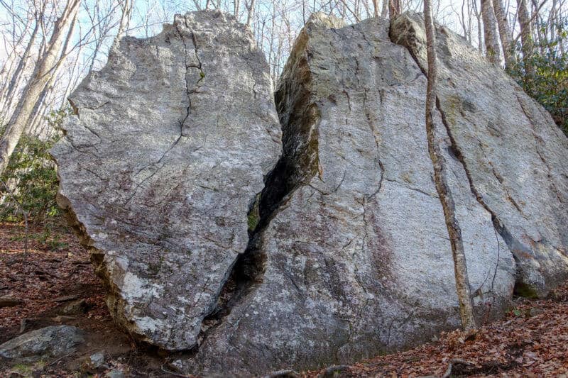
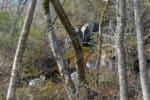
One of the geologic highlights of the trip, “Split Rock,” is impossible to miss at the half mile mark. The enormous fissure is large enough to walk through. Since Josie, my dog, wasn’t keen on the idea of trying it, we continued on. We encountered several more large boulders and rock formations along the hike, but none as impressive as this one.

For the next mile and a half beyond Split Rock, the trail continues its relentless climb until you reach the next junction indicating that the Pinnacle trail continues to the left (Black Rock can be reached by taking the trail leading to the right). We took the left fork, and after one more short pitch of ascent, the trail kindly provides a break from climbing. In the first two miles, we ascended nearly 1,800 feet which exceeds what I deem an “able to hold a conversation comfortably” elevation gain per mile.
-
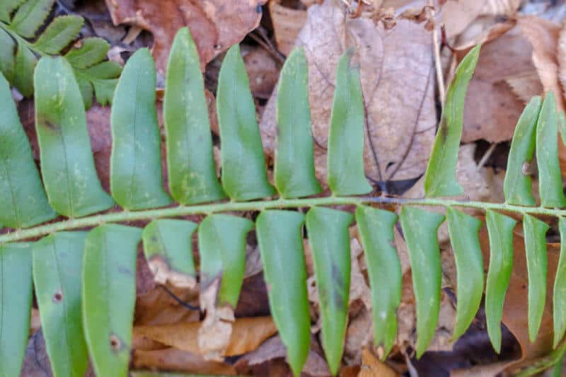
- Christmas Fern
-
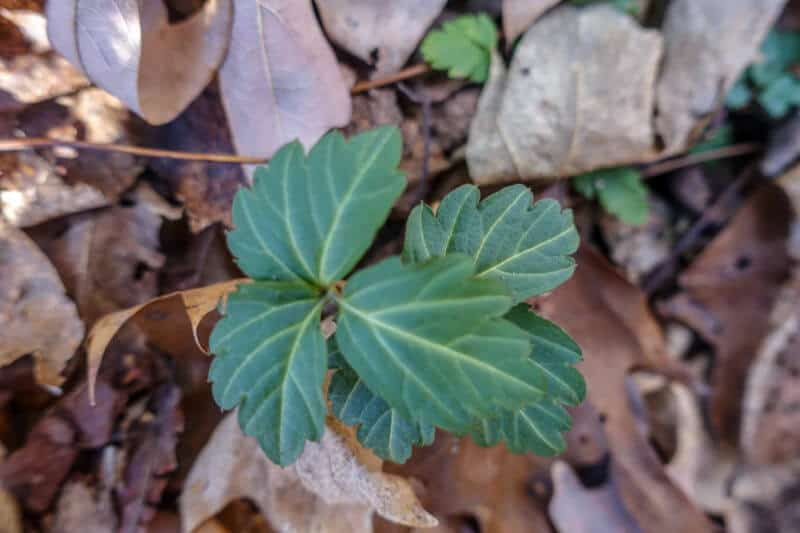
- Toothwort
-
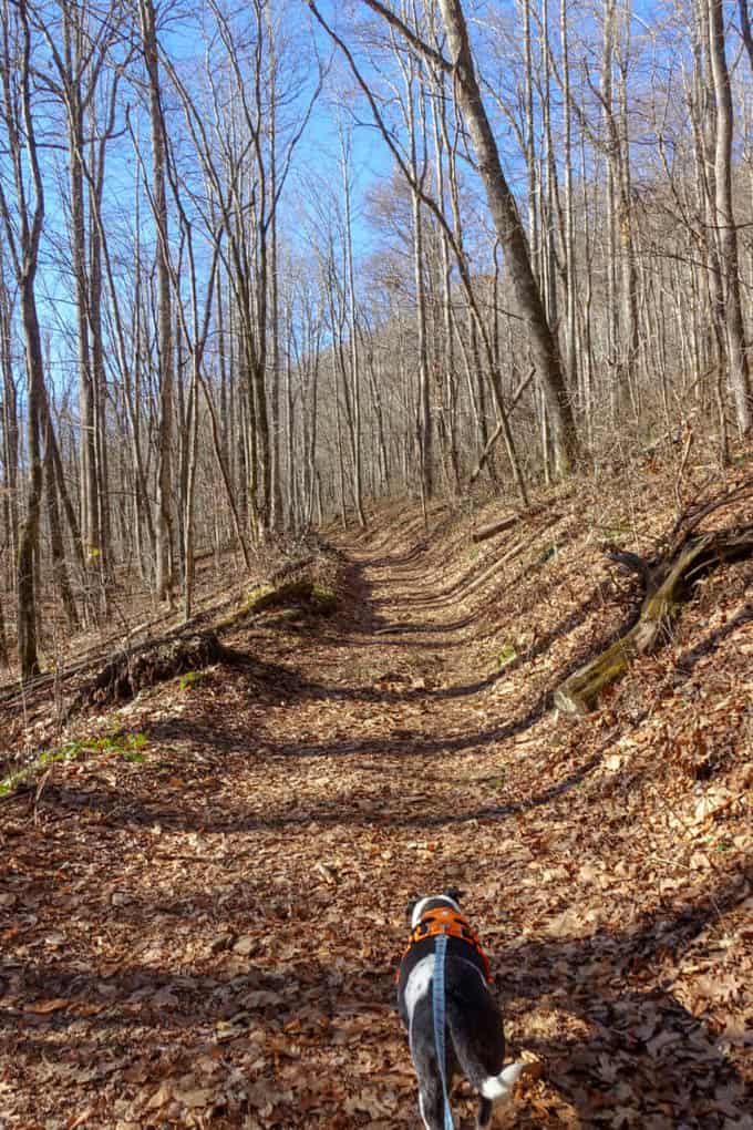
- Finally the climb lets up some
-
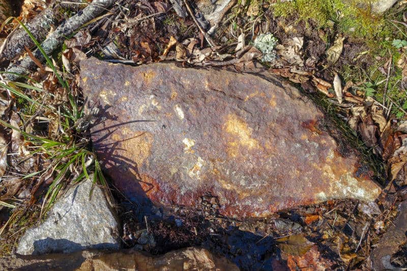
- Iron stained rock
-
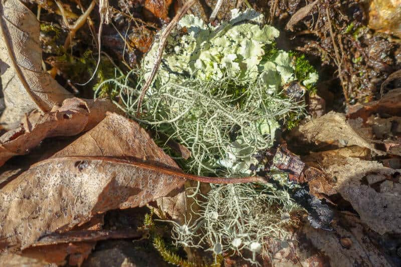
- Freddy Fungus took a “lichen” to Alice Algae–a clever way to remember what lichen is comprised of!
-
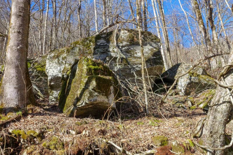
- Awesome boulders the entire hike
-
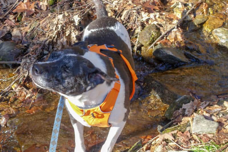
- Josie was just as happy as I was about being in the woods.
-
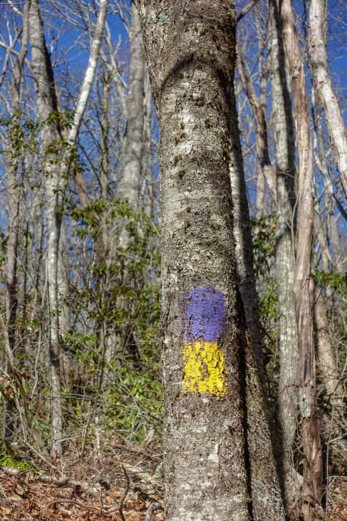
- Catamount pride shines through
For the next 1.4 miles, along a much more gentle stretch of trail, I could better appreciate the views unfolding through the bare winter landscape. There is a slightly sloped campsite labeled “3” along this stretch. Just beyond that, I encountered remnants of a late fall snow storm on both the trail and on the north facing boulders beside the trail.
-
- The ice formations were spectacular!
-
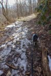
- Avoiding the snow
-
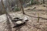
- Campsite #3
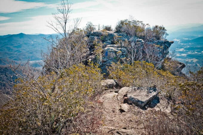
Eventually, the trail descended a short ways through thick rhododendron and emerged with a view of our destination: The Pinnacle.
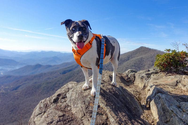
The Pinnacle itself is a large rocky outcropping with 360 degree views of the Plott Balsams to the east, The Great Balsam range and town of Sylva to the south, and even Clingman’s Dome, the highest point in Tennessee and the entire Appalachian Trail, peeking out to the northwest behind you.
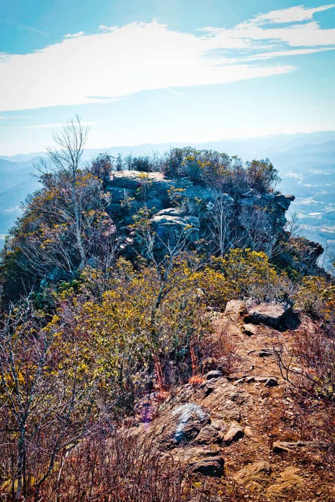
The Pinnacle
Queen of the Hill
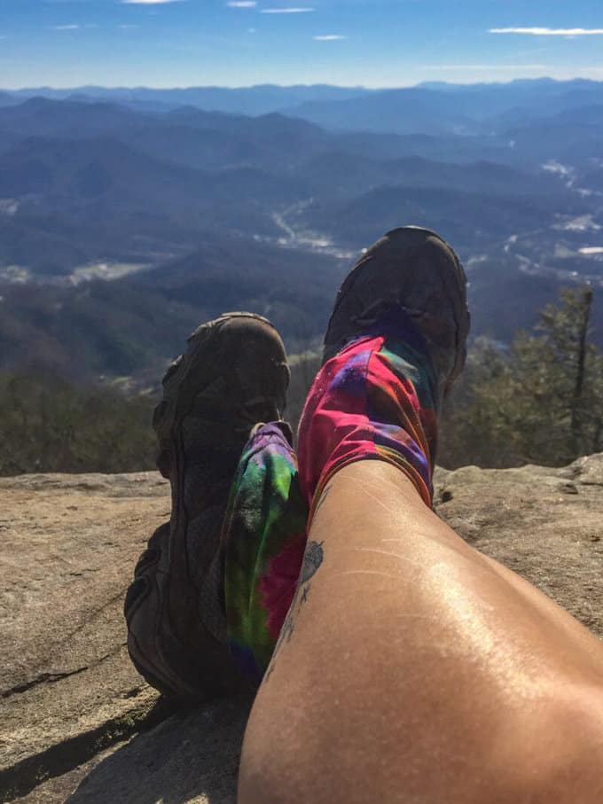
Just to sit and stare felt like such a treat!
On this unseasonably warm day, I made sure I built in enough time to soak in the views and enjoy the first lunch I’d eaten sitting down in a month. A couple soon joined me with their dog, the first people I encountered on the trail that day.
After lunch, I reluctantly tore myself away from the blissful perch and descended via the same route, encountering about a dozen people along the way. The early bird gets the worm of an empty trail I suppose, and I was thankful for the solitude while it lasted. All in all, it was the best Christmas gift anyone could give myself and I look forward to adding this to my repeat list of local day hikes.
Trail Report Card
Overall Grade: A. I really enjoyed this trail for a short day hike close to home. I look forward to hiking it in all four seasons as it will likely feel like an entirely new trail each time.
Mileage: My total hike was 6.8 miles. The ascent was 2071 feet over 3.4 miles with a matching descent of equal distance. I consider this a difficult hike, despite the short distance, due to the elevation gain and loss.
Type of Hike: Out and back; however, this trail could be combined with the East Fork trail in the park with an ascent of Blackrock, to create a lollipop loop hike. Pay attention to your footing as you traverse the rocks leading to the Pinnacle. It would be a bad fall (and long rescue) if you slipped.
Suitability for Kids: I would not take young (<8 years old) kids to the Pinnacle because I think the ascent could possibly squelch their enthusiasm for the hike. I would, however, take them as far as Split Rock since it’s a site to behold, and the nearby water of Fisher Creek would be a fun warm weather destination. This option would be a 1-mile round trip hike. Older kids (>8 years) would be fine for the entire hike, as long as they are in good physical shape.
Dog Friendly: Yes, on leashes, especially at the Pinnacle where there are sheer drop offs.
Solitude Level: Expect company. It’s popular with locals.
Map Resource: National Geographic Trails Illustrated Map #785
How to Get Here: From the east, as you are approaching Sylva on Smoky Mountain Parkway (Hwy 23, 74), turn right onto Steeple Rd (just before the BP Gas Station on the right) and follow it a short distance until it dead ends into Skyland Drive. Turn left on to Skyland Drive and then turn right on to Fisher Creek Road. Follow Fisher Creek Road to the gravel parking area. There is a trail kiosk with a required registration form (no fee) but there were no registration cards available the day I hiked the trail.
Gaia GPS Track of West Fork Pinnacle Hike
[content-upgrade id=”3163″]
SaveSave